monyony
monyony is a hotel in Makindye Division, Kampala Capital City, Central Uganda. monyony is situated nearby to the park Munyonyo Commonwealth Resort, as well as near Mango Garden.| Tap on a place to explore it |
Places of Interest Nearby
Highlights include Munyonyo Commonwealth Resort and Bulingugwe Island.
Munyonyo Commonwealth Resort
Park
Munyonyo Commonwealth Resort is a five star hotel-resort in Kampala, the capital and largest city in Uganda, the third-largest economy in the East African Community.
Bulingugwe Island
Island
Bulingugwe Island is a small island in northern Lake Victoria. It is about 6 miles south of Kampala, Uganda. After the Battle of Mengo Hill in which the Uganda Army raided the Lubiri Palace on 24 January 1892, the Kabaka Mwanga II of Buganda fled to exile there briefly.
St. Denis Ssebugwawo Secondary School
School
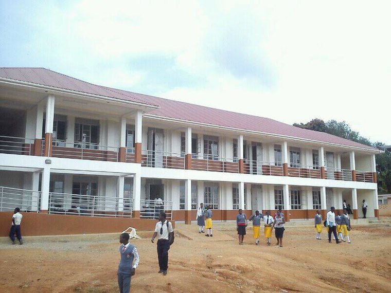
Photo: Wikimedia, CC BY-SA 3.0.
St. Denis Ssebugwawo Secondary School is a Ugandan mixed day and boarding school, located in Ggaba, Kampala District. The school covers senior one to senior six classes. St. Denis Ssebugwawo Secondary School is situated 2½ km north of monyony.
Places in the Area
Nearby places include Munyonyo and Ggaba.
Munyonyo
Suburb

Photo: Wulman83, CC BY-SA 3.0.
Munyonyo is an area on the northern shores of Lake Victoria and part of the metropolitan area of Kampala, in Makindye Division.
Ggaba
Suburb
Ggaba is a neighborhood within the city of Kampala in the Central Region of Uganda. Ggaba is situated 3 km north of monyony.
Kigo
Village
Kigo is a neighborhood in the town of Ssabagabo in Uganda. The name also refers to Kigo Hill, that forms part of the neighborhood. Kigo is situated 4½ km southwest of monyony.
monyony
- Type: Hotel
- Categories: tourism, accommodation, and building
- Location: Makindye Division, Kampala Capital City, Kampala District, Central Uganda, Uganda, East Africa, Africa
- View on OpenStreetMap
Latitude
0.23747° or 0° 14′ 15″ northLongitude
32.62438° or 32° 37′ 28″ eastOpen location code
6GGJ6JPF+XQOpenStreetMap ID
node 8296358417OpenStreetMap feature
tourism=hotel
This page is based on OpenStreetMap, Wikidata, and Wikimedia Commons.
We’d love your help improving our open data sources. Thank you for contributing.
Satellite Map
Discover monyony from above in high-definition satellite imagery.
In Other Languages
“monyony” goes by many names.
- Arabic: “مونيونيو كامبالا”
Notable Places Nearby
Highlights include Mango Garden and Infinity Pool.
Nearby Places
Explore places such as Nyanja Restaurant and Viking Bar.
Central Uganda: Must-Visit Destinations
Delve into Kampala, Entebbe, Masaka, and Ssese Islands.
Curious Places to Discover
Uncover intriguing places from every corner of the globe.
About Mapcarta. Data © OpenStreetMap contributors and available under the Open Database License". Text is available under the CC BY-SA 4.0 license, except for photos, directions, and the map. Photo: Wikimedia, CC0.