Weißer Knott - Rocca Bianca
Weißer Knott - Rocca Bianca is a peak in Stelvio, South Tyrol, Trentino-Alto Adige and has an elevation of 2,451 metres. Weißer Knott - Rocca Bianca is situated nearby to the locality Tarscher Alm - Alpe di Tarres, as well as near the hamlet Untere Tartscher Alm.| Tap on a place to explore it |
Places of Interest
Highlights include Stelvio Pass and Piz da las Trais Linguas.
Stelvio Pass
Mountain saddle

Photo: Kallerna, CC BY-SA 4.0.
The Stelvio Pass is a mountain pass in northern Italy bordering Switzerland at an elevation of 2,757 m above sea level. It is the highest paved mountain pass in the Eastern Alps, and the second highest in the Alps, 7 m below France's Col de l'Iseran.
Piz da las Trais Linguas
Peak
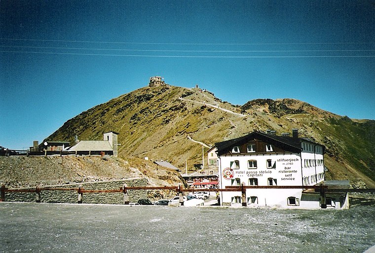
Photo: 2000, CC BY-SA 3.0.
Piz da las Trais Linguas, is a minor summit of the Ortler Alps, located on the border between Switzerland and Italy. The summit is the tripoint between the Italian regions of Lombardy and South Tyrol and the Swiss canton of Graubünden.
Piz Cotschen
Peak

Photo: Idéfix, CC BY-SA 3.0.
Piz Cotschen, also named Rötlspitz or Punta Rosa, is a mountain of the Ortler Alps, overlooking both the Umbrail and Stelvio Pass. Its summit is located within the Swiss canton of Graubünden, near the border with Italy.
Places in the Area
Nearby places include Trafoi.

Weißer Knott - Rocca Bianca
- Type: Peak with an elevation of 2,451 metres
- Category: landform
- Location: Stelvio, South Tyrol, Trentino-Alto Adige, Northeast Italy, Italy, Europe
- View on OpenStreetMap
Latitude
46.5371° or 46° 32′ 14″ northLongitude
10.4851° or 10° 29′ 7″ eastElevation
2,451 metres (8,041 feet)Open location code
8FRGGFPP+V3OpenStreetMap ID
node 8297413605OpenStreetMap feature
natural=peak
This page is based on OpenStreetMap, Wikidata, and Wikimedia Commons.
We’d love your help improving our open data sources. Thank you for contributing.
Satellite Map
Discover Weißer Knott - Rocca Bianca from above in high-definition satellite imagery.
Localities in the Area
Explore places such as Tarscher Alm - Alpe di Tarres and Untere Tartscher Alm.
Notable Places Nearby
Highlights include Schwarzwand - Croda Nera and Artilleriestellung Goldsee 1. Weltkrieg - Posizione d’Artiglieria Lago d’Oro 1a Guerra mondiale.
South Tyrol: Must-Visit Destinations
Delve into Bolzano, Brixen, Merano, and Bruneck.
Curious Peaks to Discover
Uncover intriguing peaks from every corner of the globe.
About Mapcarta. Data © OpenStreetMap contributors and available under the Open Database License". Text is available under the CC BY-SA 4.0 license, except for photos, directions, and the map. Photo: Benreis, CC BY 3.0.