Elystan Street
Elystan Street is a London restaurant co-owned by chef patron Phil Howard and Rebecca Mascarenhas. Howard and Mascarenhas established the restaurant on 27 September 2016, six months after Howard sold and left his previous restaurant The Square.| Tap on a place to explore it |
- Type: Restaurant
- Description: restaurant in London, England
- Address: 43 Elystan Street
Places of Interest Nearby
Highlights include Natural History Museum and Science Museum.
Natural History Museum
Museum
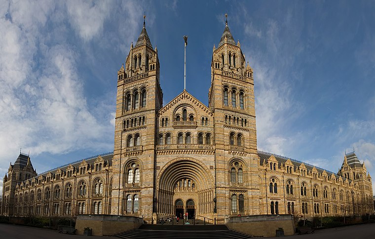
Photo: Diliff, CC BY-SA 3.0.
The Natural History Museum in London is a museum that exhibits a vast range of specimens from various segments of natural history. It is one of three major museums on Exhibition Road in South Kensington, the others being the Science Museum and the Victoria and Albert Museum. Natural History Museum is situated 2,600 feet northwest of Elystan Street.
Science Museum
Museum

Photo: Shadowssettle, CC BY-SA 4.0.
The Science Museum is a major museum on Exhibition Road in South Kensington, London. It was founded in 1857 and is one of the city's major tourist attractions, attracting 3.3 million visitors annually in 2019. Science Museum is situated 2,800 feet northwest of Elystan Street.
Royal Albert Hall
Theater building

Photo: Sandpiper, Public domain.
The Royal Albert Hall is a concert hall on the northern edge of South Kensington, London, England. It has a seating capacity of 5,272. Since the hall's opening by Queen Victoria in 1871, the world's leading artists from many performance genres have appeared on its stage. Royal Albert Hall is situated 4,100 feet northwest of Elystan Street.
Places in the Area
Nearby places include Sutton Dwellings and Chelsea.
Sutton Dwellings
Neighborhood

Photo: PAUL FARMER, CC BY-SA 2.0.
Sutton Dwellings, also known as the Sutton Estate, are a series of 14 residential buildings in Chelsea, London, U.K.
Chelsea
Suburb

Photo: Danny Robinson, CC BY-SA 2.0.
Chelsea is an area in West London, England, due south-west of Charing Cross by approximately 2.5 miles. It lies on the north bank of the River Thames and for postal purposes is part of the south-western postal area.
Brompton
Suburb

Photo: Wjfox2005, Public domain.
Brompton, sometimes called Old Brompton, survives in name as a ward in the Royal Borough of Kensington and Chelsea in London. Until the latter half of the 19th century it was a scattered village made up mostly of market gardens in the county of Middlesex.
Elystan Street
- Category: food
- Location: South Kensington-Chelsea, Greater London, London, England, United Kingdom, Britain and Ireland, Europe
- View on OpenStreetMap
Latitude
51.49163° or 51° 29′ 30″ northLongitude
-0.16777° or 0° 10′ 4″ westOpen location code
9C3XFRRJ+MVOpenStreetMap ID
node 8305153314OpenStreetMap feature
amenity=restaurantWikidata ID
Q107123010
This page is based on OpenStreetMap, Wikidata, Wikimedia Commons, and Wikipedia.
We’d love your help improving our open data sources. Thank you for contributing.
Satellite Map
Discover Elystan Street from above in high-definition satellite imagery.
In Other Languages
“Elystan Street” goes by many names.
- Turkish: “Elystan Street”
Notable Places Nearby
Highlights include Marlborough Primary School and KX Gym Health Club.
Nearby Places
Explore places such as Robinson Pelham and Claremont.
London: Must-Visit Destinations
Delve into Heathrow Airport, City of London, Westminster, and South London.
Curious Restaurants to Discover
Uncover intriguing restaurants from every corner of the globe.
About Mapcarta. Data © OpenStreetMap contributors and available under the Open Database License". Text is available under the CC BY-SA 4.0 license, except for photos, directions, and the map. Description text is based on the Wikipedia page “Elystan Street”. Photo: Peter Suranyi, CC BY-SA 3.0.