Gas & Food Mart
Gas & Food Mart is a convenience store in Battle Creek, Calhoun, Michigan which is located on West Michigan Avenue. Gas & Food Mart is situated nearby to the museum Historic Adventist Village, as well as near the pitch Carson Rizor Athletic Field.| Tap on a place to explore it |
Places of Interest Nearby
Highlights include Battle Creek Regional History Museum and Battle Creek Transportation Center.
Battle Creek Regional History Museum
Museum
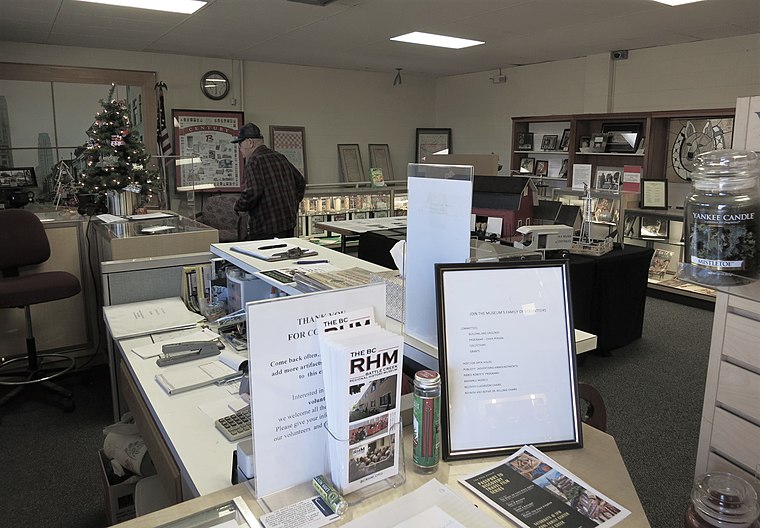
Photo: Gpwitteveen, CC BY-SA 3.0.
Battle Creek Regional History Museum is situated 1,500 feet southeast of Gas & Food Mart.
Battle Creek Transportation Center
Railway station
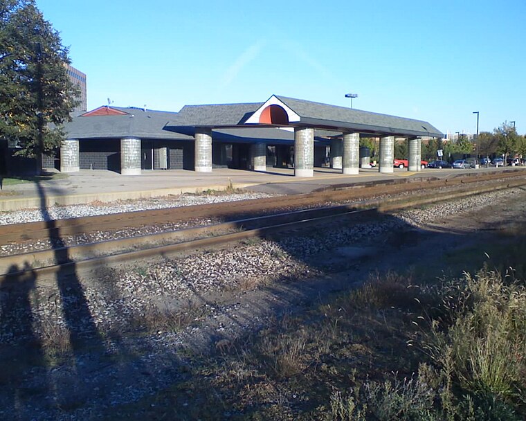
Photo: Dp67, Public domain.
Battle Creek Transportation Center is an intermodal station in Battle Creek, Michigan, used by Amtrak, Indian Trails and Greyhound Lines. It is at the split between the routes of Amtrak's Blue Water and Wolverine passenger trains. Battle Creek Transportation Center is situated 3,900 feet southeast of Gas & Food Mart.
Kellogg Arena
Stadium

Photo: Gpwitteveen, CC BY-SA 3.0.
Kellogg Arena is a 6,200-seat multi-purpose arena located in Battle Creek, Michigan. Kellogg Arena is situated 4,100 feet southeast of Gas & Food Mart.
Places in the Area
Nearby places include Brownlee Park.
Brownlee Park
Village
Brownlee Park is a census-designated place in Calhoun County in the U.S. state of Michigan.The population was 2,021 at the 2020 census. The CDP is immediately east of the city of Battle Creek and is part of the Battle Creek Metropolitan Statistical Area. Brownlee Park is situated 3 miles east of Gas & Food Mart.
Gas & Food Mart
- Type: Convenience store
- Address: 420 West Michigan Avenue, Battle Creek, MI 49037
- Categories: shop and food
- Location: Battle Creek, Calhoun, Michigan, Midwest, United States, North America
- View on OpenStreetMap
Latitude
42.3265° or 42° 19′ 35″ northLongitude
-85.19699° or 85° 11′ 49″ westOpen location code
86JP8RG3+J6OpenStreetMap ID
node 8353705631OpenStreetMap feature
shop=convenience
This page is based on OpenStreetMap, Wikidata, and Wikimedia Commons.
We’d love your help improving our open data sources. Thank you for contributing.
Satellite Map
Discover Gas & Food Mart from above in high-definition satellite imagery.
Notable Places Nearby
Highlights include Historic Adventist Village and Carson Rizor Athletic Field.
Nearby Places
Explore places such as Citgo and Ziebart.
Michigan: Must-Visit Destinations
Delve into Detroit, Ann Arbor, Lansing, and Grand Rapids.
Curious Convenience Stores to Discover
Uncover intriguing convenience stores from every corner of the globe.
About Mapcarta. Data © OpenStreetMap contributors and available under the Open Database License". Text is available under the CC BY-SA 4.0 license, except for photos, directions, and the map. Photo: Traveler100, CC BY-SA 4.0.