Red Lane Crossing
Red Lane Crossing is a level crossing in Disley, Cheshire East, England. Red Lane Crossing is situated nearby to the deciduous forest Burymewick Wood, as well as near Arnold Rhodes Playground.| Tap on a place to explore it |
Places of Interest Nearby
Highlights include Disley railway station and New Mills Newtown railway station.
Disley railway station
Railway station

Photo: Peter Whatley, CC BY-SA 2.0.
Disley railway station serves the village of Disley in Cheshire, England. It is sited 12+1⁄3 miles south-east of Manchester Piccadilly on the Buxton Line, built by the Stockport, Disley and Whaley Bridge Railway. Disley railway station is situated 3,700 feet west of Red Lane Crossing.
New Mills Newtown railway station
Railway station
 New Mills Newtown railway station serves the Newtown area of New Mills, in Derbyshire, England. It is located 14+1⁄4 miles south east of Manchester Piccadilly on the Buxton line. New Mills Newtown railway station is situated 3,900 feet east of Red Lane Crossing.
St Mary’s Church, Disley
Church

Photo: Wikimedia, CC BY-SA 2.0.
St Mary's Church is an Anglican parish church in the diocese of Chester, the archdeaconry of Macclesfield and the deanery of Chadkirk. It is on a hill overlooking the village of Disley, Cheshire, England. St Mary’s Church, Disley is situated 3,000 feet west of Red Lane Crossing.
Places in the Area
Nearby places include Hague Bar and Newtown.
Hague Bar
Village
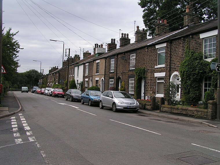
Photo: Dave Dunford, CC BY-SA 2.0.
Hague Bar is a hamlet in New Mills, Derbyshire, near Marple and Stockport. The Manchester to Sheffield railway passes through the Goyt valley at this point.
Newtown
Suburb

Photo: Jeremy Hinks, CC BY-SA 2.0.
Newtown is an area of the town of New Mills, in the High Peak borough of Derbyshire, England. It is situated to the south-west of New Mills town centre, on the road towards Disley. The area lies beside the county boundary between Cheshire and Derbyshire.
New Mills

Photo: Alan Murray-Rust, CC BY-SA 2.0.
New Mills is in Derbyshire. It's unlikely to feature on many itineraries in its own right, but it's worth stopping off for an hour or two if travelling between Manchester and the Peak District.
Red Lane Crossing
- Type: Level crossing
- Category: transportation
- Location: Disley, Cheshire East, England, United Kingdom, Britain and Ireland, Europe
- View on OpenStreetMap
Latitude
53.35939° or 53° 21′ 34″ northLongitude
-2.02594° or 2° 1′ 33″ westOpen location code
9C5V9X5F+QJOpenStreetMap ID
node 8372149912OpenStreetMap feature
railway=crossing
This page is based on OpenStreetMap, Wikidata, and Wikimedia Commons.
We’d love your help improving our open data sources. Thank you for contributing.
Satellite Map
Discover Red Lane Crossing from above in high-definition satellite imagery.
Notable Places Nearby
Highlights include Burymewick Wood and Arnold Rhodes Playground.
Nearby Places
Explore places such as Red Lane Crossing and Danebank, Buxton Road / opposite #128.
England: Must-Visit Destinations
Delve into London, Manchester, Sheffield, and Leeds.
Curious Level Crossings to Discover
Uncover intriguing level crossings from every corner of the globe.
About Mapcarta. Data © OpenStreetMap contributors and available under the Open Database License". Text is available under the CC BY-SA 4.0 license, except for photos, directions, and the map. Photo: sidibousaid, CC BY 2.0.