Cœur d’Acier
Cœur d’Acier is a farm in Poinçon-lès-Larrey, Arrondissement of Montbard, Bourgogne-Franche-Comté. Cœur d’Acier is situated nearby to the village Noiron-sur-Seine.| Tap on a place to explore it |
Places of Interest Nearby
Highlights include Château de Larrey and Église Saint-Germain-d’Auxerre de Poinçon-lès-Larrey.
Château de Larrey
Castle

Photo: Claude PIARD, CC BY-SA 4.0.
Château de Larrey is a castle, which is situated 2½ km southwest of Cœur d’Acier.
Église Saint-Germain-d’Auxerre de Poinçon-lès-Larrey
Church
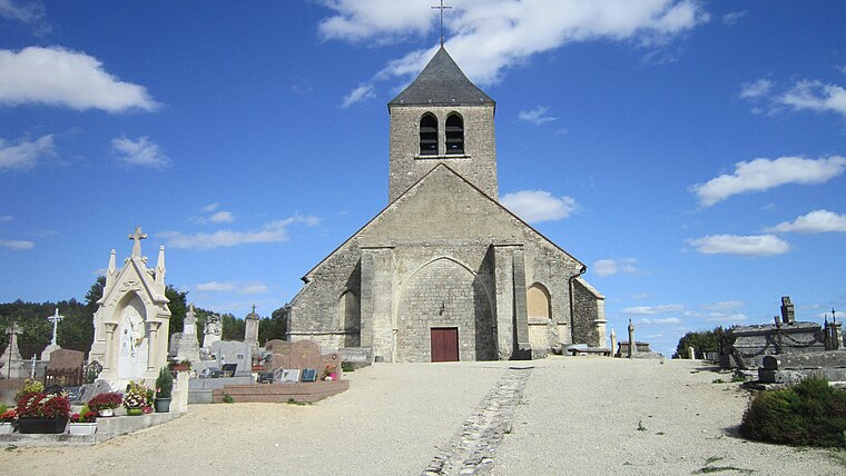
Photo: Claude PIARD, CC BY-SA 4.0.
Église Saint-Germain-d’Auxerre de Poinçon-lès-Larrey is a church, which is situated 2½ km southwest of Cœur d’Acier.
Église Saint-Martin de Bouix
Church

Photo: Claude PIARD, CC BY-SA 4.0.
Église Saint-Martin de Bouix is a church, which is situated 2½ km southeast of Cœur d’Acier.
Places in the Area
Nearby places include Noiron-sur-Seine and Mussy-sur-Seine.
Noiron-sur-Seine
Village

Photo: Claude PIARD, CC BY-SA 4.0.
Noiron-sur-Seine is a commune in the Côte-d'Or department in eastern France. Noiron-sur-Seine is situated 5 km northeast of Cœur d’Acier.
Mussy-sur-Seine
Village

Photo: Peter17, CC BY-SA 4.0.
Mussy-sur-Seine is a commune in the Aube department in north-central France. Mussy-sur-Seine is situated 9 km north of Cœur d’Acier.
Plaines-Saint-Lange
Village

Photo: Gérald Garitan, CC BY-SA 4.0.
Plaines-Saint-Lange is a commune in the Aube department in north-central France. Plaines-Saint-Lange is situated 10 km north of Cœur d’Acier.
Cœur d’Acier
- Type: Farm
- Categories: locality and agriculture
- Location: Poinçon-lès-Larrey, Arrondissement of Montbard, Cote d’Or, Bourgogne-Franche-Comté, France, Europe
- View on OpenStreetMap
Latitude
47.90379° or 47° 54′ 14″ northLongitude
4.45838° or 4° 27′ 30″ eastOpen location code
8FV6WF35+G9OpenStreetMap ID
node 8390213385OpenStreetMap feature
place=farm
This page is based on OpenStreetMap, Wikidata, and Wikimedia Commons.
We’d love your help improving our open data sources. Thank you for contributing.
Satellite Map
Discover Cœur d’Acier from above in high-definition satellite imagery.
Notable Places Nearby
Highlights include Mairie de Poinçon-lès-Larrey and Agence Communale.
Nearby Places
Explore places such as Champ du Bois and Metairie - Tridon.
Bourgogne-Franche-Comté: Must-Visit Destinations
Delve into Nièvre, Dijon, Besançon, and Vesoul.
Curious Farms to Discover
Uncover intriguing farms from every corner of the globe.
About Mapcarta. Data © OpenStreetMap contributors and available under the Open Database License". Text is available under the CC BY-SA 4.0 license, except for photos, directions, and the map. Photo: CocktailSteward, CC BY 3.0.