Offenbach a. d. Queich
Offenbach a. d. Queich is in Landau in der Pfalz, Palatinate, Rhineland-Palatinate. Offenbach a. d. Queich is situated nearby to Golden Grape Ranch, as well as near the meadow Mörlheimer Wiesen.| Tap on a place to explore it |
Places of Interest Nearby
Highlights include Evangelische Kirche and St. Martin.
Evangelische Kirche
Church

Photo: RuWild, CC BY-SA 4.0.
Evangelische Kirche is a church, which is situated 750 metres southwest of Offenbach a. d. Queich.
St. Martin
Church

Photo: RuWild, CC BY-SA 4.0.
St. Martin is a church, which is situated 1 km south of Offenbach a. d. Queich.
Landau Hauptbahnhof
Railway station
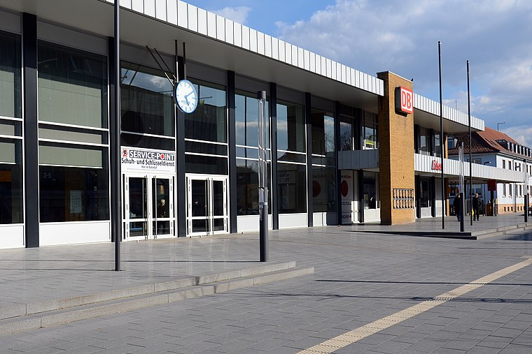
Photo: BlueBreezeWiki, CC BY-SA 3.0.
Landau Hauptbahnhof is the centre of public transport in the city of Landau in the German state of Rhineland-Palatinate. Landau Hauptbahnhof is situated 3 km west of Offenbach a. d. Queich.
Places in the Area
Nearby places include Offenbach an der Queich and Bornheim.
Offenbach an der Queich
Village

Photo: Gaskopft, CC BY-SA 3.0.
Offenbach an der Queich is a municipality in the Südliche Weinstraße district, in Rhineland-Palatinate, Germany. It is situated on the river Queich, approx.
Bornheim
Village

Photo: Mundartpoet, CC BY-SA 3.0.
Bornheim is a municipality in the Südliche Weinstraße district, in Rhineland-Palatinate, Germany. Bornheim is situated 3 km north of Offenbach a. d. Queich.
Essingen
Village

Photo: H rtner, Public domain.
Essingen is a municipality in the Südliche Weinstraße district, in Rhineland-Palatinate, Germany. Essingen is situated 4½ km north of Offenbach a. d. Queich.
Offenbach a. d. Queich
- Type: Sign
- Categories: information and tourism
- Location: Landau in der Pfalz, Palatinate, Rhineland-Palatinate, Germany, Central Europe, Europe
- View on OpenStreetMap
Latitude
49.19534° or 49° 11′ 43″ northLongitude
8.16948° or 8° 10′ 10″ eastOpen location code
8FXC55W9+4QOpenStreetMap ID
node 8407444565OpenStreetMap feature
tourism=information
This page is based on OpenStreetMap, Wikidata, and Wikimedia Commons.
We’d love your help improving our open data sources. Thank you for contributing.
Satellite Map
Discover Offenbach a. d. Queich from above in high-definition satellite imagery.
Notable Places Nearby
Highlights include Golden Grape Ranch and Mörlheimer Wiesen.
Nearby Places
Explore places such as Mörlheim, Abzweigung and THW OV Landau.
Palatinate: Must-Visit Destinations
Delve into Ludwigshafen, Speyer, Kaiserslautern, and Pirmasens.
Curious Places to Discover
Uncover intriguing places from every corner of the globe.
About Mapcarta. Data © OpenStreetMap contributors and available under the Open Database License". Text is available under the CC BY-SA 4.0 license, except for photos, directions, and the map. Photo: Anna16, CC BY-SA 4.0.