Chedworth Beacon
Chedworth Beacon is a peak in Chedworth, Cotswold District, England and has an elevation of 791 feet. Chedworth Beacon is situated nearby to the hamlet Chedworth Laines, as well as near the locality West Range.| Tap on a place to explore it |
Places of Interest
Highlights include Chedworth Roman Villa and Church of St Andrew.
Chedworth Roman Villa
Archaeological site
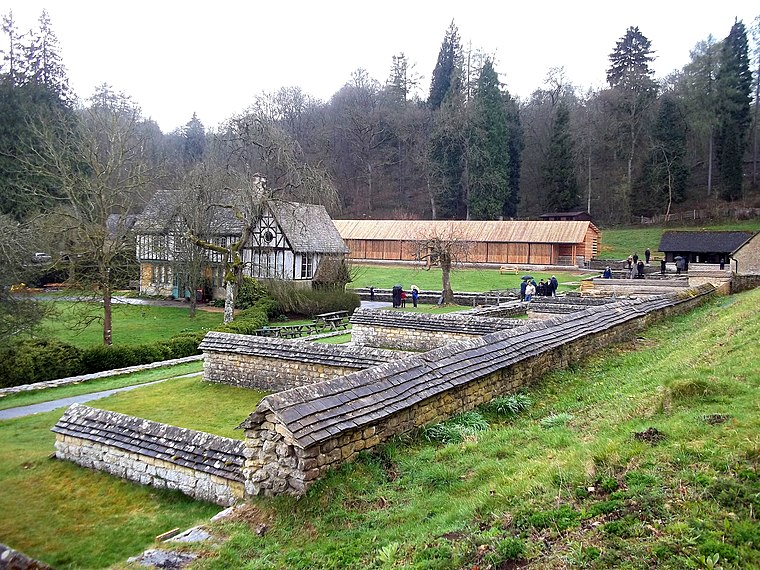 Chedworth Roman Villa is located near Chedworth, Gloucestershire, England and is a scheduled monument. It is one of the largest and most elaborate Roman villas so far discovered in Britain and one with the latest occupation beyond the Roman period.
Church of St Andrew
Church

Photo: Lloyd Bridgewater, CC BY-SA 2.0.
The Anglican Church of St Andrew at Chedworth in the Cotswold District of Gloucestershire, England was built in the late 12th century. It is a grade I listed building.
Buttress House
Historic building

Photo: Michael Dibb, CC BY-SA 2.0.
Buttress House is a historic building.
Places in the Area
Nearby places include Withington and Stowell.
Withington
Village

Photo: andy dolman, CC BY-SA 2.0.
Withington is a Cotswold village and civil parish in Gloucestershire, England, about 7 miles southeast of Cheltenham and 8 miles north of Cirencester. The River Coln runs through the village.
Stowell
Village

Photo: Derek Meek, CC BY-SA 2.0.
Stowell Park Estate is a 6,000-acre historic agricultural and sporting estate in the Cotswold Hills, Gloucestershire, England. The estate includes the village of Yanworth.
Coln Rogers
Village

Photo: Chris Denny, CC BY-SA 2.0.
Coln Rogers is a village and former civil parish, now in the parish of Coln St. Dennis, in the Cotswold district of the county of Gloucestershire, England. In 1931 the parish had a population of 95.
Chedworth Beacon
- Type: Peak with an elevation of 791 feet
- Category: landform
- Location: Chedworth, Cotswold District, Gloucestershire, West Country, England, United Kingdom, Britain and Ireland, Europe
- View on OpenStreetMap
Latitude
51.8095° or 51° 48′ 34″ northLongitude
-1.9375° or 1° 56′ 15″ westElevation
791 feet (241 metres)Open location code
9C3WR357+R2OpenStreetMap ID
node 8413146323OpenStreetMap feature
natural=peak
This page is based on OpenStreetMap, Wikidata, and Wikimedia Commons.
We’d love your help improving our open data sources. Thank you for contributing.
Satellite Map
Discover Chedworth Beacon from above in high-definition satellite imagery.
Localities in the Area
Explore places such as Chedworth Laines and West Range.
Notable Places Nearby
Highlights include The Manor and The Seven Tuns.
Gloucestershire: Must-Visit Destinations
Delve into Gloucester, Cheltenham, Cirencester, and Yate.
Curious Peaks to Discover
Uncover intriguing peaks from every corner of the globe.
About Mapcarta. Data © OpenStreetMap contributors and available under the Open Database License". Text is available under the CC BY-SA 4.0 license, except for photos, directions, and the map. Photo: Pasicles, CC0.