Max Kirchheimer
Max Kirchheimer is a memorial in Mönchengladbach, Düsseldorf, North Rhine-Westphalia. Max Kirchheimer is situated nearby to WingTsun-Schule, as well as near the church St. Maria Rosenkranz.| Tap on a place to explore it |
Places of Interest Nearby
Highlights include Mönchengladbach Hauptbahnhof and St. Maria Rosenkranz.
Mönchengladbach Hauptbahnhof
Railway station
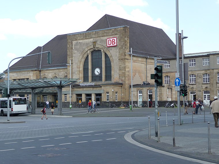
Photo: Thalan, CC BY-SA 3.0.
Mönchengladbach Hauptbahnhof is a railway station in the city of Mönchengladbach in western Germany. Mönchengladbach Hauptbahnhof is situated 760 metres southwest of Max Kirchheimer.
St. Maria Rosenkranz
Church

Photo: Chris06, CC BY-SA 4.0.
St. Maria Rosenkranz is a church, which is situated 400 metres west of Max Kirchheimer.
Evangelische Friedenskirche
Church

Photo: Wikimedia, CC BY-SA 3.0 de.
Evangelische Friedenskirche is a church, which is situated 590 metres southwest of Max Kirchheimer.
Places in the Area
Nearby places include Am Wasserturm and Lürrip.


Lockhütte
Neighborhood
 Lockhütte is a neighborhood, which is situated 3 km north of Max Kirchheimer.
Max Kirchheimer
- Type: Memorial
- Category: historic site
- Location: Mönchengladbach, Düsseldorf, Lower Rhine, North Rhine-Westphalia, Germany, Central Europe, Europe
- View on OpenStreetMap
Latitude
51.20246° or 51° 12′ 9″ northLongitude
6.45158° or 6° 27′ 6″ eastNetwork
StolpersteineOpen location code
9F386F22+XJOpenStreetMap ID
node 8450813928OpenStreetMap feature
historic=memorial
This page is based on OpenStreetMap, Wikidata, and Wikimedia Commons.
We’d love your help improving our open data sources. Thank you for contributing.
Satellite Map
Discover Max Kirchheimer from above in high-definition satellite imagery.
Notable Places Nearby
Highlights include WingTsun-Schule and TIG Theater im Gründungshaus.
Nearby Places
Explore places such as Rosa Kirchheimer and Novainfo.
Lower Rhine: Must-Visit Destinations
Delve into Düsseldorf, Krefeld, Neuss, and Kleve.
Curious Memorials to Discover
Uncover intriguing memorials from every corner of the globe.
About Mapcarta. Data © OpenStreetMap contributors and available under the Open Database License". Text is available under the CC BY-SA 4.0 license, except for photos, directions, and the map. Photo: CaS2000, CC BY-SA 3.0 de.