UCLA Margo Leavin Graduate Art Studios
UCLA Margo Leavin Graduate Art Studios is an arts center in Los Angeles, Southern California, California. UCLA Margo Leavin Graduate Art Studios is situated nearby to the sports venue LA School of Gymnastics, as well as near JAG gym.| Tap on a place to explore it |
- Type: Arts center
- Description: art studio building in Culver City, California
- Also known as: “Margo Leavin Graduate Art Studio”, “UCLA Graduate Art Studios”, “UCLA Margo Leavin Graduate Art Studio”, and “UCLA Warner Graduate Studios”
Places of Interest Nearby
Highlights include Culver City station and La Cienega/Jefferson station.
Culver City station
Railway station

Photo: METRO96, CC BY-SA 3.0.
Culver City station is an elevated light rail station on the E Line of the Los Angeles Metro Rail system. The station is located on a dedicated right-of-way alongside Exposition Boulevard — between the intersection of Venice Boulevard and Robertson Boulevard on the west and the intersection of Washington Boulevard and National Boulevard on the east. Culver City station is situated 2,600 feet northwest of UCLA Margo Leavin Graduate Art Studios.
La Cienega/Jefferson station
Railway station

Photo: Wikimedia, CC BY-SA 2.0.
La Cienega/Jefferson station is an elevated light rail station on the E Line of the Los Angeles Metro Rail system. The station is over the intersection of La Cienega Boulevard and Jefferson Boulevard, after which the station is named, in the Baldwin Hills neighborhood of Los Angeles. La Cienega/Jefferson station is situated 2,900 feet east of UCLA Margo Leavin Graduate Art Studios.
Museum of Jurassic Technology
Museum
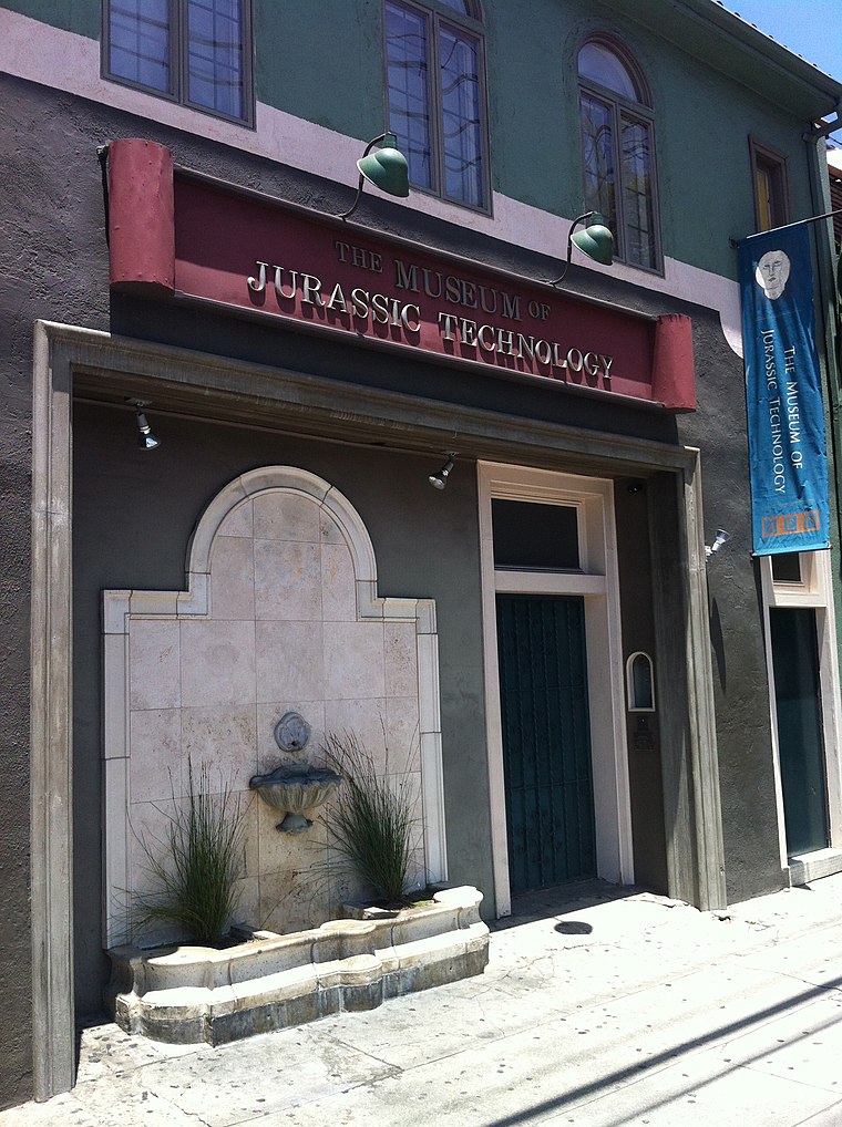
Photo: Tore Danielsson, CC BY-SA 4.0.
The Museum of Jurassic Technology at 9341 Venice Boulevard in the Palms district of Los Angeles, California, was founded by David Hildebrand Wilson and Diana Drake Wilson in 1988. Museum of Jurassic Technology is situated 4,200 feet west of UCLA Margo Leavin Graduate Art Studios.
Places in the Area
Nearby places include Reynier Village and Culver City.
Reynier Village
Neighborhood

Photo: Phatblackmama, CC BY-SA 4.0.
Reynier Village is a neighborhood on the Westside of Los Angeles, California. The Reynier Village neighborhood was known as Reynier Park in the 1920s and 1930s although the actual city park was not established until the late 1970s.
Culver City

Photo: Wikimedia, CC BY-SA 3.0.
Culver City is a city on the Westside of Los Angeles County. It was given the moniker the "Heart of Screenland" during the 1930s and 1940s when it was responsible for half of America's motion picture production; today it remains home to Sony Pictures Studios and Culver Studios.
Castle Heights
Neighborhood
Castle Heights is a neighborhood on the Westside of the city of Los Angeles, California. Founded in 1922, the neighborhood contains roughly 900 single-family residences, along with multi-family apartments and condominiums with a limited amount of commercial property.
UCLA Margo Leavin Graduate Art Studios
- Categories: school building, university building, green building, tourist attraction, and tourism
- Location: Los Angeles, Southern California, California, United States, North America
- View on OpenStreetMap
Latitude
34.02413° or 34° 1′ 27″ northLongitude
-118.38148° or 118° 22′ 53″ westOpen location code
85632JF9+MCOpenStreetMap ID
node 8487325134OpenStreetMap feature
amenity=arts_centreWikidata ID
Q106988735
This page is based on OpenStreetMap, Wikidata, and Wikimedia Commons.
We’d love your help improving our open data sources. Thank you for contributing.
Satellite Map
Discover UCLA Margo Leavin Graduate Art Studios from above in high-definition satellite imagery.
Notable Places Nearby
Highlights include LA School of Gymnastics and JAG gym.
Nearby Places
Explore places such as Vespertine and Destroyer.
Los Angeles: Must-Visit Destinations
Delve into Hollywood, San Gabriel Valley, San Fernando Valley, and Long Beach.
Curious Arts Centers to Discover
Uncover intriguing arts centers from every corner of the globe.
About Mapcarta. Data © OpenStreetMap contributors and available under the Open Database License". Text is available under the CC BY-SA 4.0 license, except for photos, directions, and the map. Photo: Mfield, CC BY-SA 3.0.