Sydenham Library
Sydenham Library is a library in Lewisham, Greater London, England. Sydenham Library is situated nearby to Home Park, as well as near Our Lady and St Philip Neri Roman Catholic Primary School.| Tap on a place to explore it |
Places of Interest Nearby
Highlights include St Michael’s and All Angels and Lower Sydenham railway station.
St Michael’s and All Angels
Church

Photo: John Salmon, CC BY-SA 2.0.
St Michael’s and All Angels is a church, which is situated 880 feet north of Sydenham Library.
Lower Sydenham railway station
Railway station

Photo: Sunil060902, CC BY-SA 3.0.
Lower Sydenham railway station is located on the boundary of the London Borough of Bromley and the London Borough of Lewisham, in south-east London, England. Lower Sydenham railway station is situated 1,800 feet southeast of Sydenham Library.
Church of All Saints
Church

Photo: Stephen Craven, CC BY-SA 2.0.
Church of All Saints is situated 1,500 feet southwest of Sydenham Library.
Places in the Area
Nearby places include Bell Green and Sydenham.
Bell Green
Quarter

Photo: Derek Harper, CC BY-SA 2.0.
Bell Green is an area in the London Borough of Lewisham, between Perry Vale and Bellingham. The area was historically known for its gas works and the poverty of the local workers, in what Charles Booth called "the one really poor district in this quarter of London." The gasworks closed in 1968 and the whole area redeveloped; it is best known today for the eponymous retail park.
Sydenham
Town
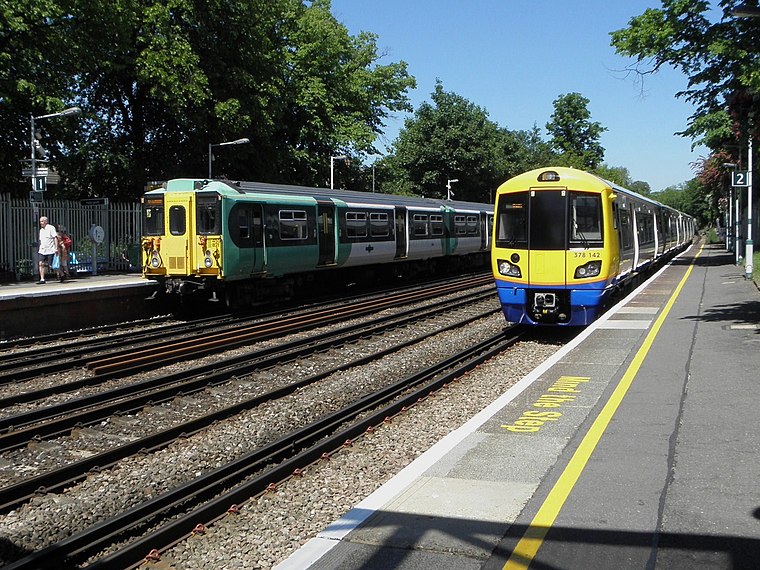
Photo: Sunil060902, CC BY-SA 3.0.
Sydenham is a district of south-east London, England, which is shared between the London boroughs of Lewisham, Bromley and Southwark. Prior to the creation of the County of London in 1889, Sydenham was located in Kent, bordering Surrey.
Perry Vale
Suburb
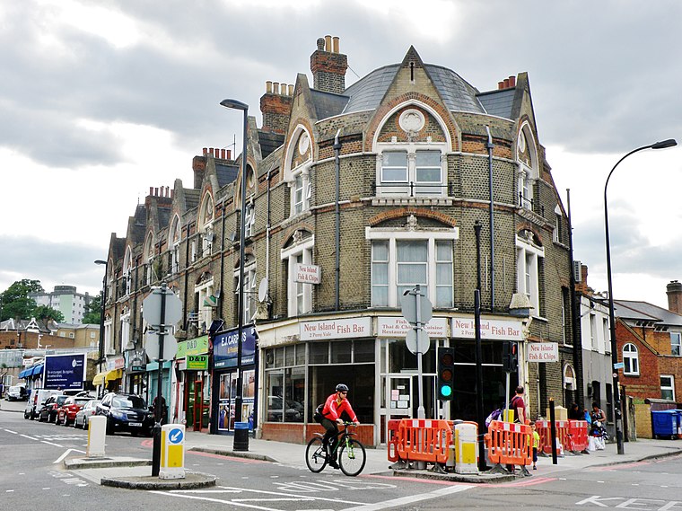
Photo: alvaro errandonea, CC BY 3.0.
Perry Vale is a neighbourhood and electoral ward in the London Borough of Lewisham. It is 10.5 km southeast of Charing Cross and located near Forest Hill to the east of Forest Hill railway station, where the railway line forms the western boundary.
Sydenham Library
- Type: Library
- Category: education
- Location: Lewisham, Greater London, England, United Kingdom, Britain and Ireland, Europe
- View on OpenStreetMap
Latitude
51.42692° or 51° 25′ 37″ northLongitude
-0.04065° or 0° 2′ 26″ westOpen location code
9C3XCXG5+QPOpenStreetMap ID
node 848850621OpenStreetMap feature
amenity=library
This page is based on OpenStreetMap, Wikidata, and Wikimedia Commons.
We’d love your help improving our open data sources. Thank you for contributing.
Satellite Map
Discover Sydenham Library from above in high-definition satellite imagery.
Notable Places Nearby
Highlights include Home Park and Our Lady and St Philip Neri Roman Catholic Primary School.
Nearby Places
Explore places such as Highclere Street and Byron Close.
England: Must-Visit Destinations
Delve into London, Manchester, Sheffield, and Leeds.
Curious Libraries to Discover
Uncover intriguing libraries from every corner of the globe.
About Mapcarta. Data © OpenStreetMap contributors and available under the Open Database License". Text is available under the CC BY-SA 4.0 license, except for photos, directions, and the map. Photo: sidibousaid, CC BY 2.0.