BP
BP is a gas station in Macomb County, Michigan which is located on Utica Road. BP is situated nearby to Upton House Museum, as well as near Farmer’s Market Pavilion.| Tap on a place to explore it |
- Opening hours:
Monday—Friday: 5:30 AM—11:00 PM
Saturday: 7:00 AM—11:00 PM
Sunday: 7:00 AM—10:00 PM - Type: Gas station
- Address: 40375 Utica Road, Sterling Heights, MI 48313
Places of Interest Nearby
Highlights include Stevenson High School and Henry Ford II High School.
Stevenson High School
School
Adlai E. Stevenson High School is a public high school located in Sterling Heights, Michigan, a suburb of Detroit. Stevenson is a part of Utica Community Schools, Michigan's second largest school district. Stevenson High School is situated 1,700 feet southwest of BP.
Henry Ford II High School
School
Henry Ford II High School is a public high school located in the Metropolitan Detroit region in the city of Sterling Heights, Michigan, United States. It is a part of Utica Community Schools. Henry Ford II High School is situated 1 mile north of BP.
Sterling Heights Assembly
The Sterling Heights Assembly Plant, is a 5,000,000 sq ft automotive manufacturing factory in Sterling Heights, Michigan currently operated by Stellantis North America. Sterling Heights Assembly is situated 2 miles southwest of BP.Places in the Area
Nearby places include Sterling Heights and Utica.
Sterling Heights
Sterling Heights is a city in Macomb County in the U.S. state of Michigan. A northern suburb of Detroit, Sterling Heights is located roughly 18 miles north of downtown Detroit.Utica
Town
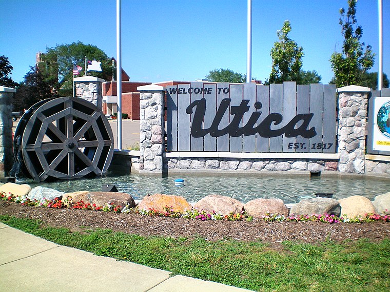
Photo: Wikimedia, Public domain.
Utica is a city in Macomb County in the U.S. state of Michigan. Its population was 5,245 at the 2020 census, up from 4,757 in 2010. Utica is situated 2½ miles northwest of BP.
Charter Township of Clinton
Town
Clinton Township is a charter township in Macomb County in the U.S. state of Michigan. A northern suburb of Detroit, Clinton Township is located about 22 miles northeast of downtown Detroit. Charter Township of Clinton is situated 4½ miles east of BP.
BP
- Category: transportation
- Location: Macomb County, Michigan, Midwest, United States, North America
- View on OpenStreetMap
Latitude
42.59099° or 42° 35′ 28″ northLongitude
-83.01073° or 83° 0′ 39″ westBrand
BPOpen location code
86JRHXRQ+9POpenStreetMap ID
node 8490566018OpenStreetMap feature
amenity=fuel
This page is based on OpenStreetMap, Wikidata, and Wikimedia Commons.
We’d love your help improving our open data sources. Thank you for contributing.
Satellite Map
Discover BP from above in high-definition satellite imagery.
Notable Places Nearby
Highlights include Upton House Museum and Farmer’s Market Pavilion.
Nearby Places
Explore places such as BP Shop and Sarah’s Heirloom.
Macomb County: Must-Visit Destinations
Delve into Warren, Sterling Heights, St. Clair Shores, and Roseville.
Curious Gas Stations to Discover
Uncover intriguing gas stations from every corner of the globe.
About Mapcarta. Data © OpenStreetMap contributors and available under the Open Database License". Text is available under the CC BY-SA 4.0 license, except for photos, directions, and the map. Photo: Wikimedia, CC0.