Hohe Satz
Hohe Satz is a peak in Hernstein, Politischer Bezirk Baden, Lower Austria and has an elevation of 527 metres. Hohe Satz is situated nearby to the hamlet Alkersdorf, as well as near the locality Kohlgruab.| Tap on a place to explore it |
Places of Interest
Highlights include Burgruine Starhemberg and Pechermuseum.
Burgruine Starhemberg
Castle
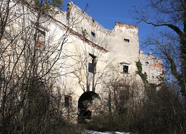
Photo: Bwag, CC BY-SA 3.0.
Burgruine Starhemberg was a castle in Lower Austria, Austria. Built in the 1140s, the castle fell into ruins by the late 19th century. Burgruine Starhemberg is 520 metres above sea level.


Places in the Area
Nearby places include Neusiedl and Grillenberg.


Hohe Satz
- Type: Peak with an elevation of 527 metres
- Category: landform
- Location: Hernstein, Politischer Bezirk Baden, Lower Austria, Austria, Central Europe, Europe
- View on OpenStreetMap
Latitude
47.8849° or 47° 53′ 6″ northLongitude
16.0987° or 16° 5′ 55″ eastElevation
527 metres (1,729 feet)Open location code
8FVRV3MX+XFOpenStreetMap ID
node 8571087772OpenStreetMap feature
natural=peak
This page is based on OpenStreetMap, Wikidata, and Wikimedia Commons.
We’d love your help improving our open data sources. Thank you for contributing.
Satellite Map
Discover Hohe Satz from above in high-definition satellite imagery.
Localities in the Area
Explore places such as Kohlgruab and Oberpiesting.
Notable Places Nearby
Highlights include Hochbehälter Alkersdorf and Hofmühlleiten.
Lower Austria: Must-Visit Destinations
Delve into St. Pölten, Wiener Neustadt, Amstetten, and Klosterneuburg.
Curious Peaks to Discover
Uncover intriguing peaks from every corner of the globe.
About Mapcarta. Data © OpenStreetMap contributors and available under the Open Database License". Text is available under the CC BY-SA 4.0 license, except for photos, directions, and the map. Photo: Lonezor, CC BY-SA 3.0.