Village Store & Café
Village Store & Café is a convenience store in Cottingham, Corby District, England. Village Store & Café is situated nearby to the church Methodist Chapel, as well as near Church of St Mary Magdalene.| Tap on a place to explore it |
Places of Interest Nearby
Highlights include Church of St Mary Magdalene and Church of St Peter, East Carlton.
Church of St Mary Magdalene
Church

Photo: Tim Heaton, CC BY-SA 2.0.
Church of St Mary Magdalene is situated 620 feet south of Village Store & Café.
Church of St Peter, East Carlton
Church

Photo: Tim Heaton, CC BY-SA 2.0.
Church of St Peter, East Carlton is situated 1 mile southwest of Village Store & Café.
St Nicholas’ Church, Bringhurst
Church

Photo: Mat Fascione, CC BY-SA 2.0.
St Nicholas' Church is a church in Bringhurst, Leicestershire. It is a Grade II* listed building. St Nicholas’ Church, Bringhurst is situated 1¼ miles north of Village Store & Café.
Places in the Area
Nearby places include Corby and Newton.
Corby

Photo: Tom walker, CC BY 3.0.
Corby is a town and civil parish in the North Northamptonshire district of Northamptonshire, England, 23 miles northeast of Northampton. In 2021 it had a population of 68,164.
Newton
Village
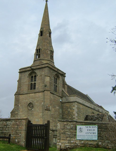
Photo: John Stolarski, CC BY-SA 2.0.
Newton, sometimes called Newton in the Willows, is a small village and former civil parish, now in the parish of Newton and Little Oakley, in the North Northamptonshire district, in the ceremonial county of Northamptonshire, England. Newton is situated 4½ miles southeast of Village Store & Café.
Desborough
Town
Desborough is a town in North Northamptonshire, England, lying in the Ise Valley between Market Harborough and Kettering. It was an industrial centre for weaving and shoe-making in the 19th century and had a long association with the Co-operative movement. Desborough is situated 5 miles southwest of Village Store & Café.
Village Store & Café
- Type: Convenience store
- Categories: shop and food
- Location: Cottingham, Corby District, North Northamptonshire, England, United Kingdom, Britain and Ireland, Europe
- View on OpenStreetMap
Latitude
52.50254° or 52° 30′ 9″ northLongitude
-0.75549° or 0° 45′ 20″ westOpen location code
9C4XG63V+2ROpenStreetMap ID
node 8584720834OpenStreetMap feature
shop=convenience
This page is based on OpenStreetMap, Wikidata, and Wikimedia Commons.
We’d love your help improving our open data sources. Thank you for contributing.
Satellite Map
Discover Village Store & Café from above in high-definition satellite imagery.
Notable Places Nearby
Highlights include Methodist Chapel and Cottingham/Middleton Village Hall.
Nearby Places
Explore places such as The Spread Eagle and Methodist Church (opp).
England: Must-Visit Destinations
Delve into London, Manchester, Sheffield, and Leeds.
Curious Convenience Stores to Discover
Uncover intriguing convenience stores from every corner of the globe.
About Mapcarta. Data © OpenStreetMap contributors and available under the Open Database License". Text is available under the CC BY-SA 4.0 license, except for photos, directions, and the map. Photo: sidibousaid, CC BY 2.0.