Épicerie Duquet
Épicerie Duquet is a convenience store in Sainte-Claire, Chaudière-Appalaches, Quebec which is located on Chemin de la Rivière-Etchemin. Épicerie Duquet is situated nearby to the cemetery Cimetière Sainte-Claire, as well as near the park Parc Eugène-Prévost.| Tap on a place to explore it |
Places in the Area
Nearby places include Honfleur and Saint-Lazare-de-Bellechasse.
Honfleur
Village
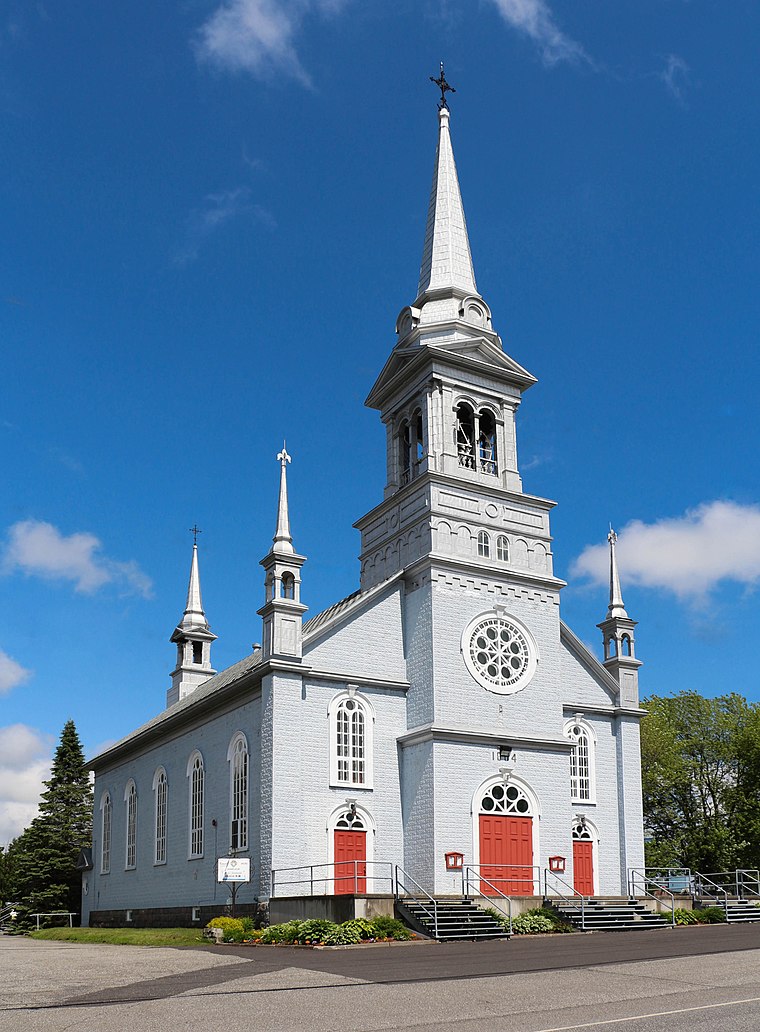
Photo: Bgag, CC BY-SA 3.0.
Honfleur is a municipality of approximately 850 people in the Bellechasse Regional County Municipality in the Chaudière-Appalaches region of Quebec. The Boyer River takes its source in the municipality. Honfleur is situated 7 km north of Épicerie Duquet.
Saint-Lazare-de-Bellechasse
Village
Saint-Lazare is a small village of 1,200 people founded in 1849 and is the seat of the Bellechasse Regional County Municipality, part of the Chaudière-Appalaches administrative region. Saint-Lazare-de-Bellechasse is situated 8 km northeast of Épicerie Duquet.
Saint-Anselme
Town

Photo: Bgag, CC BY-SA 3.0.
Saint-Anselme is a village in the Bellechasse Regional County Municipality, part of the Chaudière-Appalaches administrative region of Quebec, Canada. It is the second biggest municipality in the RCM, after Saint-Henri. Saint-Anselme is situated 9 km northwest of Épicerie Duquet.
Épicerie Duquet
- Type: Convenience store
- Address: 447 Chemin de la Rivière-Etchemin, Sainte-Claire, Québec
- Categories: shop and food
- Location: Sainte-Claire, Chaudière-Appalaches, Central Quebec, Quebec, Canada, North America
- View on OpenStreetMap
Latitude
46.59469° or 46° 35′ 41″ northLongitude
-70.86623° or 70° 51′ 58″ westOpen location code
87RFH4VM+VGOpenStreetMap ID
node 8740069754OpenStreetMap feature
shop=convenience
This page is based on OpenStreetMap, Wikidata, and Wikimedia Commons.
We’d love your help improving our open data sources. Thank you for contributing.
Satellite Map
Discover Épicerie Duquet from above in high-definition satellite imagery.
Notable Places Nearby
Highlights include Cimetière Sainte-Claire and Parc Taschereau.
Nearby Places
Explore places such as Services agricoles Aubé and Manoir de la Rive Claire.
Chaudière-Appalaches: Must-Visit Destinations
Delve into Lévis, Saint-Georges, Montmagny, and Grosse Isle.
Curious Convenience Stores to Discover
Uncover intriguing convenience stores from every corner of the globe.
About Mapcarta. Data © OpenStreetMap contributors and available under the Open Database License". Text is available under the CC BY-SA 4.0 license, except for photos, directions, and the map. Photo: Wikimedia, CC BY-SA 4.0.