Grange Farm
Grange Farm is a farm in The Stukeleys, Huntingdonshire, England. Grange Farm is situated nearby to The Church of Jesus Christ of Latter-day Saints, as well as near the community center Great Stukeley Village Hall.| Tap on a place to explore it |
Places of Interest Nearby
Highlights include RAF Alconbury and Cromwell Museum.
RAF Alconbury
Military installation
Royal Air Force Alconbury, or more simply RAF Alconbury, is an active Royal Air Force station near Huntingdon, England, that for many years was used by the USAF. RAF Alconbury is situated 1½ miles northwest of Grange Farm.
Cromwell Museum
Museum

Photo: Rob enwiki, CC BY-SA 3.0.
The Cromwell Museum in Huntingdon, England, is a museum containing collections exploring the life of Oliver Cromwell and to a lesser extent his son Richard Cromwell. Cromwell Museum is situated 2 miles south of Grange Farm.
Huntingdon railway station
Railway station
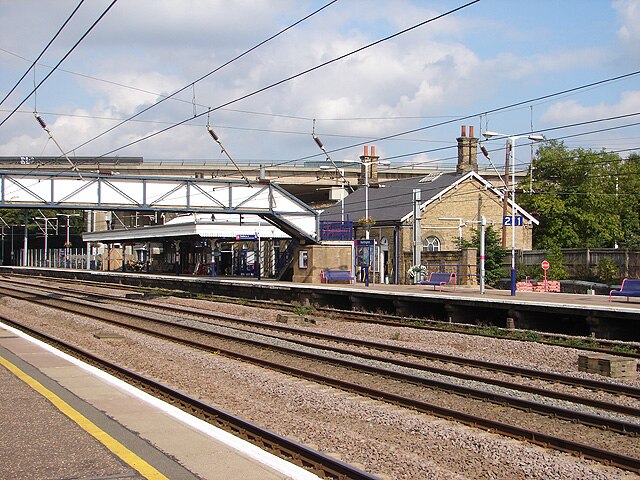
Photo: OLU, CC BY-SA 2.0.
Huntingdon railway station serves the market town of Huntingdon in Cambridgeshire, England. It is on the East Coast Main Line, 58 miles 70 chains from London King's Cross, and has three platforms: one bay and two through platforms. Huntingdon railway station is situated 2 miles south of Grange Farm.
Places in the Area
Nearby places include Great Stukeley and Sapley.
Great Stukeley
Village
Great Stukeley is a village and former civil parish, now in the parish of The Stukeleys. It is 1.8 miles north-west of Huntingdon. Great Stukeley is in Huntingdonshire which is a non-metropolitan district of Cambridgeshire as well as a historic county of England.
Sapley
Suburb

Photo: Simon Mortimer, CC BY-SA 2.0.
Sapley is a historic village in Cambridgeshire, now a suburb of Huntingdon.
Little Stukeley
Village
Little Stukeley is a village and former civil parish, now in the parish of The Stukeleys, in Cambridgeshire, England. Little Stukeley lies approximately 3 miles north-west of Huntingdon.
Grange Farm
- Type: Farm
- Category: agriculture
- Location: The Stukeleys, Huntingdonshire, Cambridgeshire, England, United Kingdom, Britain and Ireland, Europe
- View on OpenStreetMap
Latitude
52.35631° or 52° 21′ 23″ northLongitude
-0.20166° or 0° 12′ 6″ westOpen location code
9C4X9Q4X+G8OpenStreetMap ID
node 874157058OpenStreetMap feature
landuse=farm
This page is based on OpenStreetMap, Wikidata, and Wikimedia Commons.
We’d love your help improving our open data sources. Thank you for contributing.
Satellite Map
Discover Grange Farm from above in high-definition satellite imagery.
Places with the Same Name
Discover other places named “Grange Farm”.
Notable Places Nearby
Highlights include The Church of Jesus Christ of Latter-day Saints and Great Stukeley Village Hall.
Nearby Places
Explore places such as Washingley Farm and Stukeley Park.
England: Must-Visit Destinations
Delve into London, Manchester, Sheffield, and Leeds.
Curious Farms to Discover
Uncover intriguing farms from every corner of the globe.
About Mapcarta. Data © OpenStreetMap contributors and available under the Open Database License". Text is available under the CC BY-SA 4.0 license, except for photos, directions, and the map. Photo: sidibousaid, CC BY 2.0.