Malmesbury Park Road
Malmesbury Park Road is a bus stop in Bournemouth, Christchurch and Poole Council, England. Malmesbury Park Road is situated nearby to the health club BourneFit, as well as near Charminster Road Post Office.| Tap on a place to explore it |
Places of Interest Nearby
Highlights include Bournemouth railway station and Wimborne Road Cemetery.
Bournemouth railway station
Railway station
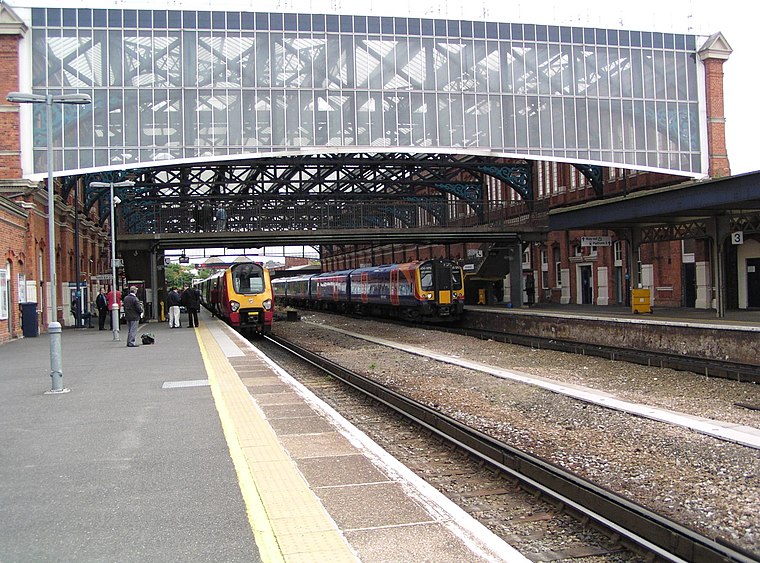
Photo: Our Phellap, CC BY-SA 3.0.
Bournemouth railway station serves the seaside town of Bournemouth, in Dorset, England. It was known previously as Bournemouth East and then Bournemouth Central. Bournemouth railway station is situated 3,000 feet south of Malmesbury Park Road.
Wimborne Road Cemetery
Cemetery

Photo: Chris Downer, CC BY-SA 2.0.
The Wimborne Road Cemetery is located at Wimborne Road, Bournemouth. It is grade II listed with Historic England. The cemetery was opened in 1878 and laid out by the architect Christopher Crabb Creeke. Wimborne Road Cemetery is situated 1,500 feet west of Malmesbury Park Road.
Church of St Andrew
Church

Photo: Mat Tuck, CC BY-SA 2.0.
Church of St Andrew is situated 2,000 feet east of Malmesbury Park Road.
Places in the Area
Nearby places include Charminster and Winton.
Charminster
Suburb
Charminster is a residential and commercial suburb of Bournemouth in Dorset, situated between the suburbs of Springbourne and Winton. It was incorporated into the County Borough of Bournemouth in 1901.
Winton
Suburb

Photo: Chris Downer, CC BY-SA 2.0.
Winton is a suburb of Bournemouth, in the Bournemouth, Christchurch and Poole district, in the ceremonial county of Dorset, England. It lies approximately 1 mile north of Bournemouth town centre, along Wimborne Road.
Springbourne
Suburb

Photo: Chris Downer, CC BY-SA 2.0.
Springbourne is a suburb of Bournemouth in Dorset, England. It occupies the north-east part of the main built-up area, north of Boscombe. Its formal boundaries are Northcote Road to the west, the Wessex Way to the north, Ashley Road to the east, and the railway line to the south.
Malmesbury Park Road
- Type: Bus stop
- Category: transportation
- Location: Bournemouth, Christchurch and Poole Council, England, United Kingdom, Britain and Ireland, Europe
- View on OpenStreetMap
Latitude
50.73529° or 50° 44′ 7″ northLongitude
-1.86745° or 1° 52′ 3″ westOpen location code
9C2WP4PM+42OpenStreetMap ID
node 8742632692OpenStreetMap feature
highway=bus_stopOpenStreetMap feature
public_transport=platform
This page is based on OpenStreetMap, Wikidata, and Wikimedia Commons.
We’d love your help improving our open data sources. Thank you for contributing.
Satellite Map
Discover Malmesbury Park Road from above in high-definition satellite imagery.
Places with the Same Name
Discover other places named “Malmesbury Park Road”.
Notable Places Nearby
Highlights include Charminster Road Post Office and BourneFit.
Nearby Places
Explore places such as Golden Time and Juicy Shakes.
England: Must-Visit Destinations
Delve into London, Manchester, Sheffield, and Leeds.
Curious Bus Stops to Discover
Uncover intriguing bus stops from every corner of the globe.
About Mapcarta. Data © OpenStreetMap contributors and available under the Open Database License". Text is available under the CC BY-SA 4.0 license, except for photos, directions, and the map. Photo: sidibousaid, CC BY 2.0.