Distelsand
Distelsand is a tram stop in Mannheim, Karlsruhe Region, Baden-Württemberg. Distelsand is situated nearby to the church St. Antonius (Mannheim), as well as near the community center Nachbarschaftshaus Rheinau.| Tap on a place to explore it |
Places of Interest Nearby
Highlights include St. Antonius (Mannheim) and Mannheim-Rheinau station.
St. Antonius (Mannheim)
Church

Photo: Frank-m, CC BY-SA 3.0.
St. Antonius (Mannheim) is a church, which is situated 130 metres north of Distelsand.
Mannheim-Rheinau station
Railway station
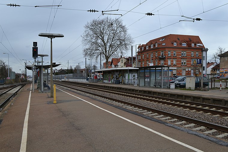
Photo: Telford, CC BY-SA 3.0.
Mannheim-Rheinau station is a railway station, which is situated 560 metres southeast of Distelsand.
Martinskirche
Church

Photo: Frank-m, CC BY-SA 3.0.
Martinskirche is a church, which is situated 1¼ km south of Distelsand.
Places in the Area
Nearby places include Altrip and Hochstätt.
Altrip
Village

Photo: Immanuel Giel, Public domain.
Altrip is a municipality in the Rhein-Pfalz-Kreis, in Rhineland-Palatinate, Germany. It is situated on the left bank of the Rhine, approx. 7 km southeast of Ludwigshafen. The population in 2022 was 7,728. Altrip is situated 2½ km west of Distelsand.

Brühl
Town

Photo: Frank-m, CC BY-SA 2.5.
Brühl is a municipality in the Rhein-Neckar district of Baden-Württemberg, Germany. The former fishing village along the Rhine has become a satellite of a growing Mannheim. Brühl is situated 3½ km south of Distelsand.
Distelsand
- Type: Tram stop
- Categories: railway stop, transport stop, and transportation
- Location: Mannheim, Karlsruhe Region, Rhine-Neckar, Baden-Württemberg, Germany, Central Europe, Europe
- View on OpenStreetMap
Latitude
49.42827° or 49° 25′ 42″ northLongitude
8.53138° or 8° 31′ 53″ eastOpen location code
8FXCCGHJ+8GOpenStreetMap ID
node 8764353704OpenStreetMap feature
public_transport=stop_positionOpenStreetMap feature
railway=tram_stop
This page is based on OpenStreetMap, Wikidata, and Wikimedia Commons.
We’d love your help improving our open data sources. Thank you for contributing.
Satellite Map
Discover Distelsand from above in high-definition satellite imagery.
Notable Places Nearby
Highlights include Nachbarschaftshaus Rheinau and Bürgerservice Rheinau.
Nearby Places
Explore places such as Timiris Motorsport GmbH and Dirk Frey.
Rhine-Neckar: Must-Visit Destinations
Delve into Heidelberg, Karlsruhe, Heilbronn, and Sinsheim.
Curious Tram Stops to Discover
Uncover intriguing tram stops from every corner of the globe.
About Mapcarta. Data © OpenStreetMap contributors and available under the Open Database License". Text is available under the CC BY-SA 4.0 license, except for photos, directions, and the map. Photo: HubiB, CC BY 2.5.