Pointe du Batéguier
Pointe du Batéguier is a cape in Cannes, Arrondissement of Grasse, Provence-Alpes-Côte d’Azur.| Tap on a place to explore it |
Places of Interest
Highlights include Palais des Festivals et des Congrès and Promenade de la Croisette.
Palais des Festivals et des Congrès
Convention center

Photo: Timantha102938, Public domain.
The Palais des Festivals et des Congrès is a convention centre in Cannes, France. It is the primary venue for the annual Cannes Film Festival, the Cannes Lions International Festival of Creativity, MIPIM, and the NRJ Music Awards.
Promenade de la Croisette
Park

Photo: Nikita, CC BY-SA 2.5.
The Promenade de la Croisette, or Boulevard de la Croisette, is a prominent road in Cannes, France. It stretches along the shore of the Mediterranean Sea and is about 2 km long.
Cannes Railway Station
Railway station
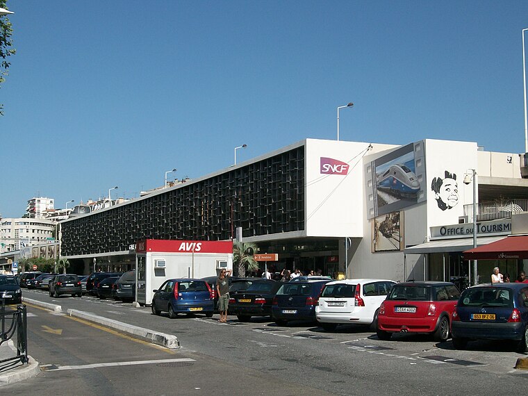
Photo: Kyah117, CC BY-SA 3.0.
Cannes station or Cannes-Voyageurs is the main railway station for the French Southern city of Cannes. It is situated on the Marseille–Ventimiglia railway.
Places in the Area
Nearby places include Cannes and La Pointe de l’Aiguille.
Cannes

Photo: Afernand74, CC BY 2.5.
Once a small fishing village on the French Riviera, Cannes is now a glamorous and expensive seaside town of 73,000 people considered to be one of the social hubs of Europe.
La Pointe de l’Aiguille
La Pointe de l'Aiguille is a natural park next to the city of Théoule-sur-mer in the Alpes-Maritimes.Mougins

Photo: Evelyscher, CC BY-SA 4.0.
Mougins is a commune in the Alpes-Maritimes department in the region of Provence-Alpes-Côte d'Azur, Southeastern France. It is located on the heights of Cannes, in the arrondissement of Grasse.
Pointe du Batéguier
- Type: Cape
- Category: landform
- Location: Cannes, Arrondissement of Grasse, Alpes-Maritimes, Provence-Alpes-Côte d’Azur, France, Europe
- View on OpenStreetMap
Latitude
43.5236° or 43° 31′ 25″ northLongitude
7.0324° or 7° 1′ 57″ eastOpen location code
8FM9G2FJ+FXOpenStreetMap ID
node 8811707250OpenStreetMap feature
natural=cape
This page is based on OpenStreetMap, Wikidata, and Wikimedia Commons.
We’d love your help improving our open data sources. Thank you for contributing.
Satellite Map
Discover Pointe du Batéguier from above in high-definition satellite imagery.
Localities in the Area
Explore places such as La Maure and La Lepre.
Notable Places Nearby
Highlights include Centre d’incendie et de secours de l’Île Sainte-Marguerite and Four à boulets.
Alpes-Maritimes: Must-Visit Destinations
Delve into Nice, Cannes, Antibes, and Menton.
Curious Capes to Discover
Uncover intriguing capes from every corner of the globe.
About Mapcarta. Data © OpenStreetMap contributors and available under the Open Database License". Text is available under the CC BY-SA 4.0 license, except for photos, directions, and the map. Photo: Myrabella, CC BY-SA 3.0.