Tonton Daf
Tonton Daf is a fast food restaurant in Oupeye, Liège, Wallonia. Tonton Daf is situated nearby to the community center Cercle Saint-Lambert, as well as near the library Bibliothèque communale.| Tap on a place to explore it |
Places of Interest Nearby
Highlights include Castle of Argenteau and Castle of Oupeye.
Castle of Argenteau
Castle
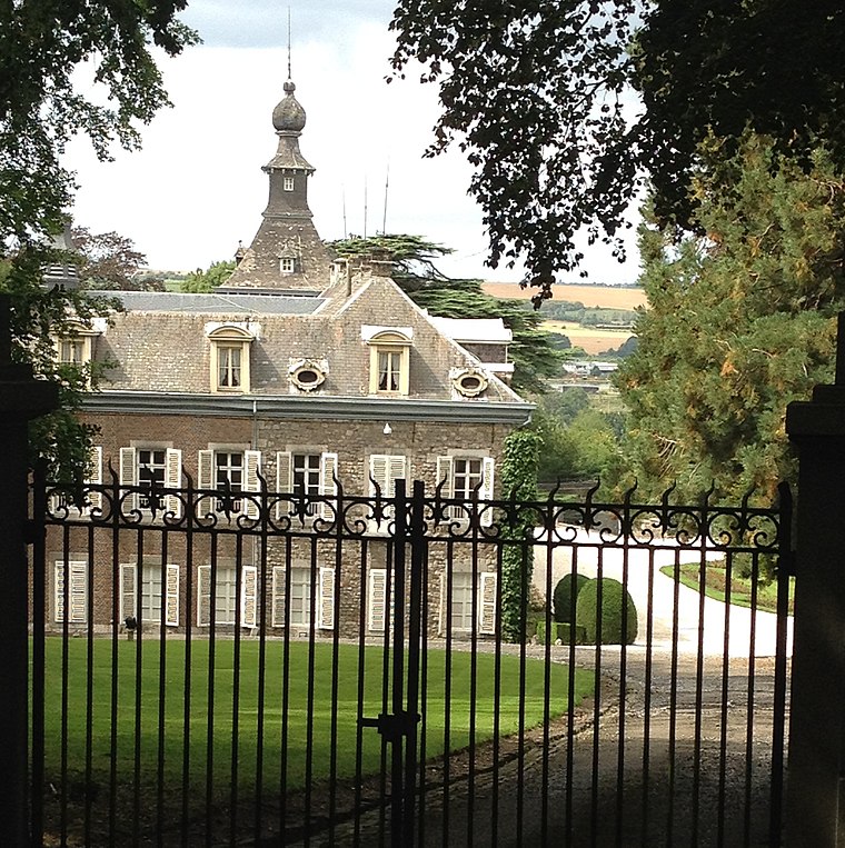
Photo: Hoebele, CC BY-SA 4.0.
Castle of Argenteau is situated 590 metres east of Tonton Daf.
Castle of Oupeye
Community center
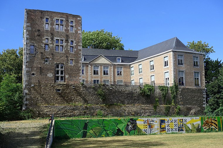
Photo: Eebie, CC BY-SA 4.0.
Castle of Oupeye is a community center, which is situated 2 km west of Tonton Daf.
Onze-Lieve-Vrouw Tenhemelopnemingskerk
Church

Photo: Sonuwe, CC BY-SA 3.0.
Onze-Lieve-Vrouw Tenhemelopnemingskerk is a church, which is situated 2 km south of Tonton Daf.
Places in the Area
Nearby places include Richelle and Argenteau.


Tonton Daf
- Type: Fast food restaurant
- Cuisine: friture and Asian
- Categories: food and restaurant
- Location: Oupeye, Liège, Liège, Wallonia, Belgium, Benelux, Europe
- View on OpenStreetMap
Latitude
50.71147° or 50° 42′ 41″ northLongitude
5.67959° or 5° 40′ 47″ eastOpen location code
9F27PM6H+HROpenStreetMap ID
node 8882404949OpenStreetMap feature
amenity=fast_foodOpenStreetMap attribute
cuisine=fritureOpenStreetMap attribute
cuisine=asian
This page is based on OpenStreetMap, Wikidata, and Wikimedia Commons.
We’d love your help improving our open data sources. Thank you for contributing.
Satellite Map
Discover Tonton Daf from above in high-definition satellite imagery.
Notable Places Nearby
Highlights include Cercle Saint-Lambert and Bibliothèque communale.
Nearby Places
Explore places such as Pharmacie Bernard and Espace Dentaire Honhon.
Curious Fast Food Restaurants to Discover
Uncover intriguing fast food restaurants from every corner of the globe.
About Mapcarta. Data © OpenStreetMap contributors and available under the Open Database License". Text is available under the CC BY-SA 4.0 license, except for photos, directions, and the map. Photo: A.Savin, CC BY-SA 3.0.