Pico dos Sete Pés
Pico dos Sete Pés is a peak in Santa Cruz das Flores, Azores and has an elevation of 849 metres. Pico dos Sete Pés is situated nearby to the hamlet Cuada, as well as near Ponta.| Tap on a place to explore it |
Places of Interest
Highlights include Flores and Lagoa Comprida.
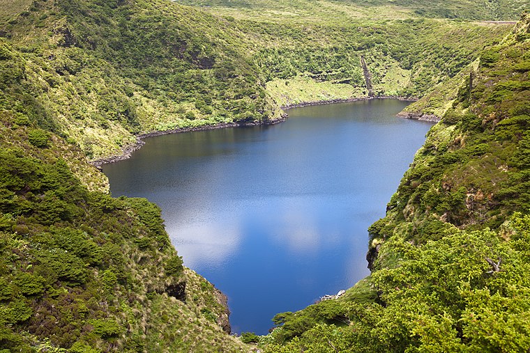
Flores

Photo: Dreizung, CC BY-SA 3.0.
Flores is an island in the Azores archipelago, an autonomous region of Portugal, in the Atlantic Ocean. It is well known for its abundance of flowers, hence its Portuguese name of Flores.
Morro Alto
Peak

Photo: Luissilveira, Public domain.
Morro Alto is the highest mountain of Flores, Azores, Portugal. It is part of a trachytic process represented by the Pico da Sé, forming an imposing volcanic apparatus embedded between two deep erosion valleys, product of the Badanela and Fazenda rivers.
Pico dos Sete Pés
- Type: Peak with an elevation of 849 metres
- Category: landform
- Location: Santa Cruz das Flores, Santa Cruz das Flores Municipality, Azores, Portugal, Iberia, Europe
- View on OpenStreetMap
Latitude
39.4533° or 39° 27′ 12″ northLongitude
-31.2094° or 31° 12′ 34″ westElevation
849 metres (2,785 feet)Open location code
89FCFQ3R+86OpenStreetMap ID
node 8895126321OpenStreetMap feature
natural=peak
This page is based on OpenStreetMap, Wikidata, and Wikimedia Commons.
We’d love your help improving our open data sources. Thank you for contributing.
Satellite Map
Discover Pico dos Sete Pés from above in high-definition satellite imagery.
In Other Languages
“Pico dos Sete Pés” goes by many names.
- Portuguese: “Pico dos Sete Pés”
Localities in the Area
Explore places such as Cuada and Ponta.
Notable Places Nearby
Highlights include Lagoa Seca and Miradouro da Lagoa Seca.
Azores: Must-Visit Destinations
Delve into Terceira, Ponta Delgada, Angra do Heroísmo, and Pico.
Curious Peaks to Discover
Uncover intriguing peaks from every corner of the globe.
About Mapcarta. Data © OpenStreetMap contributors and available under the Open Database License". Text is available under the CC BY-SA 4.0 license, except for photos, directions, and the map. Photo: Tsy1980, CC BY-SA 4.0.