Mulino del Principe
Mulino del Principe is in Castel San Lorenzo, Salerno, Campania. Mulino del Principe is situated nearby to the village Aquara, as well as near the town Roccadaspide.| Tap on a place to explore it |
Places in the Area
Nearby places include Aquara and Roccadaspide.
Aquara
Village

Photo: Geofix, CC BY-SA 3.0.
Aquara is a town and comune in the province of Salerno in the Campania region of south-western Italy.
Roccadaspide
Town
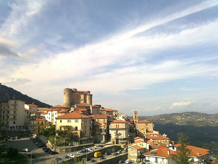
Photo: Wikimedia, CC BY-SA 3.0.
Roccadaspide is a town and comune in the province of Salerno in the Campania region of south-western Italy. Roccadaspide is situated 4 km west of Mulino del Principe.
Bellosguardo
Village

Photo: DerBorg, CC BY-SA 4.0.
Bellosguardo is a town and comune in the province of Salerno in the Campania region of south-western Italy. The name "Bellosguardo" is made up of two italian words: the first is "bello" that means "beautiful, pretty"; the second is "sguardo" meaning "view, landscape" in the italian vernacole of the place. Bellosguardo is situated 6 km east of Mulino del Principe.
Mulino del Principe
- Type: Tourist attraction
- Category: tourism
- Location: Castel San Lorenzo, Salerno, Campania, Southern Italy, Italy, Europe
- View on OpenStreetMap
Latitude
40.42538° or 40° 25′ 31″ northLongitude
15.23906° or 15° 14′ 21″ eastOpen location code
8FGQC6GQ+5JOpenStreetMap ID
node 8934549655OpenStreetMap feature
tourism=attraction
This page is based on OpenStreetMap, Wikidata, and Wikimedia Commons.
We’d love your help improving our open data sources. Thank you for contributing.
Satellite Map
Discover Mulino del Principe from above in high-definition satellite imagery.
Notable Places Nearby
Highlights include Comune di Castel San Lorenzo and Carabinieri.
Nearby Places
Explore places such as TENUTA TOSI and Impianto di depurazione.
Salerno: Must-Visit Destinations
Delve into Salerno, Amalfi, Cava de’ Tirreni, and Positano.
Curious Places to Discover
Uncover intriguing places from every corner of the globe.
About Mapcarta. Data © OpenStreetMap contributors and available under the Open Database License". Text is available under the CC BY-SA 4.0 license, except for photos, directions, and the map. Photo: Wikimedia, CC0.