Lower St Mary Street NB
Lower St Mary Street NB is a bus stop in Castle, Cardiff, Wales. Lower St Mary Street NB is situated nearby to the bar Dirty Martini, as well as near Peppermint.| Tap on a place to explore it |
Places of Interest Nearby
Highlights include Millennium Stadium and Cardiff Central Railway Station.
Millennium Stadium
Stadium

Photo: Clint Budd, CC BY 2.0.
The Millennium Stadium, known since 2016 as the Principality Stadium for sponsorship reasons, is the national stadium of Wales. Located in Cardiff, it has a retractable roof and is the home of the Wales national rugby union team; it has also held Wales national football team games. Millennium Stadium is situated 1,400 feet west of Lower St Mary Street NB.
Cardiff Central Railway Station
Railway station

Photo: Jeremy Segrott, CC BY 2.0.
Cardiff Central is a major station on the South Wales Main Line. It is located in the capital of Wales, Cardiff, 144 miles 77 chains down the line from London Paddington, via Bristol Parkway, and 170 miles 30 chains measured via Stroud. Cardiff Central Railway Station is situated 870 feet southwest of Lower St Mary Street NB.
Cardiff Central Library
Library
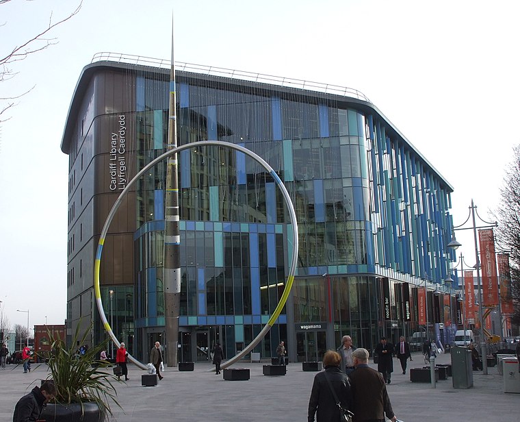
Photo: John Lord, CC BY-SA 2.0.
Cardiff Central Library is the main library in the city centre of Cardiff, Wales. It offers a public library service and is open six days a week. Four buildings have been named as such, with the newest building opening on 14 March 2009 and officially being opened a few months later on 18 June 2009 by the Manic Street Preachers. Cardiff Central Library is situated 430 feet northeast of Lower St Mary Street NB.
Places in the Area
Nearby places include Castle Quarter and Newtown.
Castle Quarter
Quarter
Castle Quarter is an independent retail destination area in the north of the city centre of Cardiff, Wales. Castle is also a community of Cardiff. The listed Castle Quarter includes some of Cardiff's Victorian and Edwardian arcades: Castle Arcade, High Street Arcade and Duke Street Arcade, and principal shopping streets: St Mary Street, High Street, Castle Street and Duke Street.
Newtown
Neighborhood

Photo: Kizpho11, CC BY-SA 3.0.
Newtown was a residential area of Cardiff, Wales that was also known as 'Little Ireland' because of its population of Irish families. Its six streets and 200 houses existed from the mid-nineteenth century until they were demolished in 1970.
Grangetown
Suburb

Photo: Mick Lobb, CC BY-SA 2.0.
Grangetown is a district and community in the south of Cardiff, capital of Wales. It is one of the largest districts in the south of the city and is bordered by Riverside, Canton and Butetown.
Lower St Mary Street NB
- Type: Bus stop
- Category: transportation
- Location: Castle, Cardiff, Wales, United Kingdom, Britain and Ireland, Europe
- View on OpenStreetMap
Latitude
51.47717° or 51° 28′ 38″ northLongitude
-3.17691° or 3° 10′ 37″ westOpen location code
9C3RFRGF+V6OpenStreetMap ID
node 8947362440OpenStreetMap feature
highway=bus_stopOpenStreetMap feature
public_transport=platform
This page is based on OpenStreetMap, Wikidata, and Wikimedia Commons.
We’d love your help improving our open data sources. Thank you for contributing.
Satellite Map
Discover Lower St Mary Street NB from above in high-definition satellite imagery.
Notable Places Nearby
Highlights include Walkabout and Dirty Martini.
Nearby Places
Explore places such as Kiwi’s and Wyndham Arcade.
Wales: Must-Visit Destinations
Delve into Swansea, Newport, Llanfairpwllgwyngyll, and Bangor.
Curious Bus Stops to Discover
Uncover intriguing bus stops from every corner of the globe.
About Mapcarta. Data © OpenStreetMap contributors and available under the Open Database License". Text is available under the CC BY-SA 4.0 license, except for photos, directions, and the map. Photo: Gordon Plant, CC BY 2.0.