Landgut Farm
Landgut Farm is a dwelling in Rhineland-Palatinate, Germany. Landgut Farm is situated nearby to the village Oberheimbach, as well as near Niederheimbach.| Tap on a place to explore it |
Places of Interest Nearby
Highlights include Sooneck Castle and Heimburg in Niederheimbach.
Sooneck Castle
Castle

Photo: Johannes Robalotoff, CC BY-SA 3.0 de.
Sooneck Castle is a castle in the upper middle valley of the Rhine, in the Mainz-Bingen district of Rhineland-Palatinate, Germany. It is located near the village of Niederheimbach between Bingen and Bacharach. Sooneck Castle is situated 1½ km east of Landgut Farm.
Heimburg in Niederheimbach
Castle
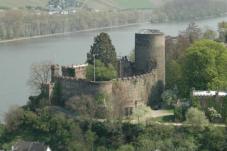
Photo: Peter Weller, CC BY-SA 3.0.
The Heimburg is a castle in the village of Niederheimbach in Rhineland-Palatinate, Germany. Heimburg in Niederheimbach is situated 1½ km north of Landgut Farm.
Siebenburgenblick Observation Tower
Scenic viewpoint

Photo: Muck50, CC BY-SA 4.0.
Siebenburgenblick Observation Tower is a scenic viewpoint, which is situated 1¼ km east of Landgut Farm.
Places in the Area
Nearby places include Oberheimbach and Niederheimbach.
Oberheimbach
Village
Oberheimbach is an Ortsgemeinde – a municipality belonging to a Verbandsgemeinde, a kind of collective municipality – in the Mainz-Bingen district in Rhineland-Palatinate, Germany. The inhabitants of this small place are known colloquially as Uhlen.
Niederheimbach
Village

Photo: Wikimedia, CC BY-SA 4.0.
Niederheimbach is an Ortsgemeinde – a municipality belonging to a Verbandsgemeinde, a kind of collective municipality – in the Mainz-Bingen district in Rhineland-Palatinate, Germany.
Oberdiebach
Village
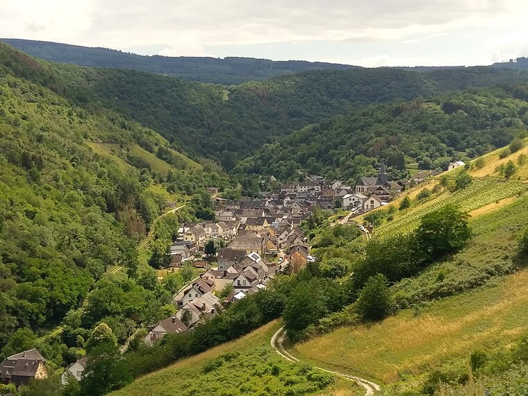
Photo: Wikimedia, CC BY-SA 4.0.
Oberdiebach is an Ortsgemeinde – a municipality belonging to a Verbandsgemeinde, a kind of collective municipality – in the Mainz-Bingen district in Rhineland-Palatinate, Germany.
Landgut Farm
- Type: Dwelling
- Address: Niederheimbach, 55413
- Categories: locality, residential building, and building
- Location: Rhineland-Palatinate, Germany, Central Europe, Europe
- View on OpenStreetMap
Latitude
50.01965° or 50° 1′ 11″ northLongitude
7.80304° or 7° 48′ 11″ eastOpen location code
9F292R93+V6OpenStreetMap ID
node 8959600840OpenStreetMap feature
place=isolated_dwelling
This page is based on OpenStreetMap, Wikidata, and Wikimedia Commons.
We’d love your help improving our open data sources. Thank you for contributing.
Satellite Map
Discover Landgut Farm from above in high-definition satellite imagery.
Notable Places Nearby
Highlights include Buckerborn and St. Margaretha.
Nearby Places
Explore places such as Finkenhof and Schutzhütte Taubenhölle.
Rhineland-Palatinate: Must-Visit Destinations
Delve into Mainz, Trier, Koblenz, and Worms.
Curious Dwellings to Discover
Uncover intriguing dwellings from every corner of the globe.
About Mapcarta. Data © OpenStreetMap contributors and available under the Open Database License". Text is available under the CC BY-SA 4.0 license, except for photos, directions, and the map. Photo: Traveler100, CC BY-SA 3.0.