Fontaine d’Arru
Fontaine d’Arru is a locality in Namur, Wallonia. Fontaine d’Arru is situated nearby to the locality Champillon, as well as near the neighborhood Sorendal.| Tap on a place to explore it |
Places of Interest
Highlights include Église Saint-Jean-Baptiste des Hautes-Rivières and Maison du Marichau.
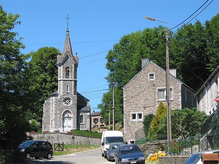
Église Saint-Jean-Baptiste des Hautes-Rivières
Church

Photo: Havang(nl), CC0.
Église Saint-Jean-Baptiste des Hautes-Rivières is a church.
Maison du Marichau
Historic building

Photo: Coalabi, CC BY-SA 3.0.
Maison du Marichau is a historic building.

Places in the Area
Nearby places include Bohan and Membre.
Bohan
Village

Photo: Jean-Pol GRANDMONT, CC BY 3.0.
Bohan is a village of Wallonia and a district of Vresse-sur-Semois, located in the province of Namur, Belgium. Most of the buildings in the village date from the 18th & 19th centuries.
Laforêt
Village

Photo: Jean-Pol GRANDMONT, CC BY 3.0.
Laforêt is a village of Wallonia and a district of the municipality of Vresse-sur-Semois, located in the province of Namur, Belgium, and is close to the French border. Laforêt is situated 5 km east of Fontaine d’Arru.
Fontaine d’Arru
Latitude
49.87204° or 49° 52′ 19″ northLongitude
4.85433° or 4° 51′ 16″ eastOpen location code
8FX6VVC3+RPOpenStreetMap ID
node 9013242214OpenStreetMap feature
place=locality
This page is based on OpenStreetMap, Wikidata, and Wikimedia Commons.
We’d love your help improving our open data sources. Thank you for contributing.
Satellite Map
Discover Fontaine d’Arru from above in high-definition satellite imagery.
Localities in the Area
Explore places such as Champillon and Sorendal.
Notable Places Nearby
Highlights include Mediatheque Jean d’Ormesson and US Bohan.
Curious Localities to Discover
Uncover intriguing localities from every corner of the globe.
About Mapcarta. Data © OpenStreetMap contributors and available under the Open Database License". Text is available under the CC BY-SA 4.0 license, except for photos, directions, and the map. Photo: Zairon, CC BY-SA 4.0.