Historische Hochwasserpegel
Historische Hochwasserpegel is a monitoring station in Lampertheim, Bergstraße, Hesse. Historische Hochwasserpegel is situated nearby to the cemetery Friedhof Rosengarten, as well as near the town hall Außenstelle Verwaltung.| Tap on a place to explore it |
Places of Interest Nearby
Highlights include Nibelungenturm and Worms Cathedral.
Nibelungenturm

Photo: Milseburg, CC BY-SA 4.0.
Nibelungenturm is situated 650 metres west of Historische Hochwasserpegel.
Worms Cathedral
Church
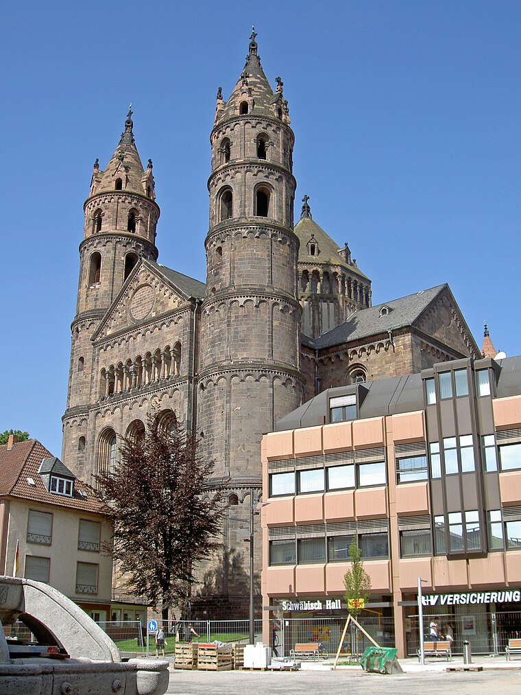
Photo: Wikimedia, CC BY-SA 3.0.
St Peter's Cathedral is a Roman Catholic church and former cathedral in Worms, southern Germany. The cathedral is located on the highest point of the inner city of Worms and is the most important building of the Romanesque style in Worms. Worms Cathedral is situated 2 km west of Historische Hochwasserpegel.
Worms Synagogue
Synagogue

Photo: HOWI, CC BY-SA 4.0.
The Worms Synagogue, also known as the Rashi Shul Synagogue, is a Jewish congregation and synagogue located in the Judengasse in the northern part of the city center of Worms, in the Rhineland-Palatinate region of Germany. Worms Synagogue is situated 1½ km west of Historische Hochwasserpegel.
Places in the Area
Nearby places include Worms and Trinity Church, Worms.
Worms

Photo: Pratz53, CC BY-SA 4.0.
Worms is a city in the Rhineland-Palatinate region of Germany. You can still see many vestiges of the old city walls, particularly the Torturmplatz and the Karolingerstraße.
Trinity Church, Worms
Locality

Photo: Immanuel Giel, Public domain.
The Holy Trinity Church, full name Reformation Memorial Church of the Holy Trinity is the largest Protestant church in Worms. The baroque hall building is centrally located on the market square of the city and is now under conservation.
Hochheim
Suburb

Photo: Lirion, CC BY-SA 3.0.
Hochheim is a suburb, which is situated 4 km west of Historische Hochwasserpegel.
Historische Hochwasserpegel
- Type: Monitoring station
- Location: Lampertheim, Bergstraße, South Hesse, Hesse, Germany, Central Europe, Europe
- View on OpenStreetMap
Latitude
49.63156° or 49° 37′ 54″ northLongitude
8.38656° or 8° 23′ 12″ eastOpen location code
8FXCJ9JP+JJOpenStreetMap ID
node 9141303091OpenStreetMap feature
man_made=monitoring_station
This page is based on OpenStreetMap, Wikidata, and Wikimedia Commons.
We’d love your help improving our open data sources. Thank you for contributing.
Satellite Map
Discover Historische Hochwasserpegel from above in high-definition satellite imagery.
Places with the Same Name
Discover other places named “Historische Hochwasserpegel”.
Notable Places Nearby
Highlights include Friedhof Rosengarten and Außenstelle Verwaltung.
Nearby Places
Explore places such as Hessischer Radfernweg R6 and Kindergarten Rosengarten.
South Hesse: Must-Visit Destinations
Delve into Darmstadt, Bensheim, Lorsch, and Heppenheim.
Curious Monitoring Stations to Discover
Uncover intriguing monitoring stations from every corner of the globe.
About Mapcarta. Data © OpenStreetMap contributors and available under the Open Database License". Text is available under the CC BY-SA 4.0 license, except for photos, directions, and the map. Photo: Mylius, GFDL.