Ostopovice
Ostopovice is a railway stop in Ostopovice, Brno-Country District, South Moravia. Ostopovice is situated nearby to the pitch Tenisové kurty, as well as near the public building Sokolovna.| Tap on a place to explore it |
Photo: Jetam2, CC BY-SA 4.0.
Places of Interest Nearby
Highlights include Chapel of St John the Baptist and Troubsko.
Chapel of St John the Baptist
Church

Photo: Harold, CC BY-SA 4.0.
Chapel of St John the Baptist is a church, which is situated 450 metres south of Ostopovice.
Troubsko
Railway station

Photo: Ben Skála, CC BY-SA 4.0.
Troubsko is a railway station, which is situated 1¼ km west of Ostopovice.
Brno-Starý Lískovec
Town hall

Photo: Podzemnik, CC BY-SA 3.0.
Brno-Starý Lískovec is a city district of Brno, Czech Republic, located on the southwestern edge of the city. It consists of most of the cadastral territory of Starý Lískovec, which has all of the city district's population, along with a small part of Nový Lískovec, originally the municipality of Lískovec, which was annexed to Brno in 1919. Brno-Starý Lískovec is situated 1½ km east of Ostopovice.
Places in the Area
Nearby places include Ostopovice and Brno-Starý Lískovec.
Ostopovice
Village

Photo: Kirk, CC BY-SA 3.0.
Ostopovice is a municipality and village in Brno-Country District in the South Moravian Region of the Czech Republic. It has about 1,800 inhabitants. Ostopovice lies approximately 7 kilometres south-west of Brno and 185 km south-east of Prague.
Brno-Bosonohy
Suburb
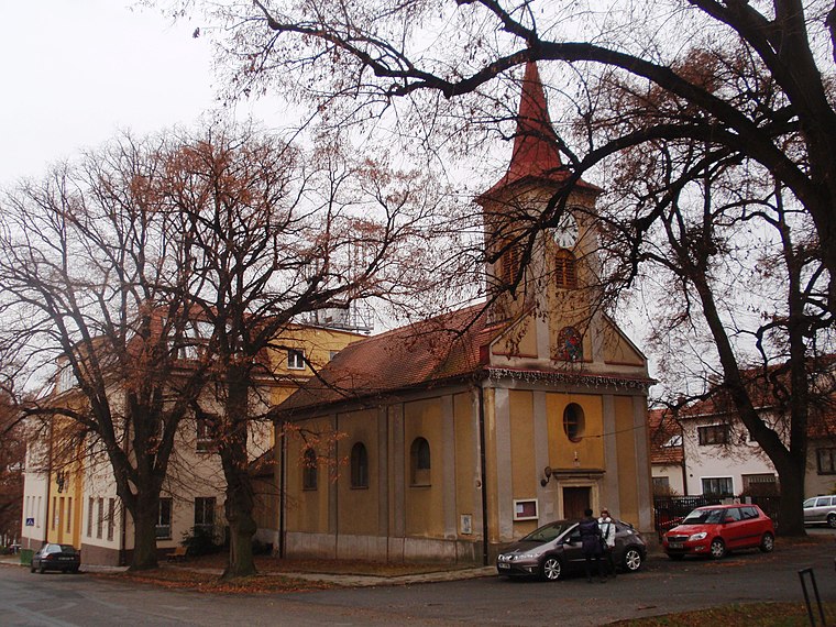
Photo: Isolda11, CC BY-SA 3.0.
Brno-Bosonohy is a city district in the southwest of the city of Brno, Czech Republic. It consists of the municipal part and cadastral territory of Bosonohy and a small part of neighbouring Kohoutovice.
Ostopovice
- Type: Railway stop
- Description: railway stop in Ostopovice, Czech Republic
- Categories: railway station, station, and transportation
- Location: Ostopovice, Brno-Country District, South Moravia, Czech Republic, Central Europe, Europe
- View on OpenStreetMap
Latitude
49.1651° or 49° 9′ 54″ northLongitude
16.54386° or 16° 32′ 38″ eastOpen location code
8FXR5G8V+2GOpenStreetMap ID
node 9163251801OpenStreetMap feature
public_transport=stationOpenStreetMap feature
railway=haltWikidata ID
Q108705132
This page is based on OpenStreetMap, Wikidata, and Wikimedia Commons.
We’d love your help improving our open data sources. Thank you for contributing.
Satellite Map
Discover Ostopovice from above in high-definition satellite imagery.
In Other Languages
From Czech to French—“Ostopovice” goes by many names.
- Czech: “Ostopovice”
- French: “Ostopovice”
Places with the Same Name
Discover other places named “Ostopovice”.
Notable Places Nearby
Highlights include Sokolovna and Tenisové kurty.
Nearby Places
Explore places such as Ostopovice and Sport Šenk.
South Moravia: Must-Visit Destinations
Delve into Brno, Zlín, Znojmo, and Kroměříž.
Curious Railway Stops to Discover
Uncover intriguing railway stops from every corner of the globe.
About Mapcarta. Data © OpenStreetMap contributors and available under the Open Database License". Text is available under the CC BY-SA 4.0 license, except for photos, directions, and the map. Photo: Jetam2, CC BY-SA 4.0.