Dowlais Bruce Hotel
Dowlais Bruce Hotel is a bus stop in Dowlais, Merthyr Tydfil, Wales. Dowlais Bruce Hotel is situated nearby to Dowlais Police Station, as well as near the chapel Ivor English Congregational Church.| Tap on a place to explore it |
Places of Interest Nearby
Highlights include Bethania Chapel, Dowlais and Dowlais Works Stables.
Bethania Chapel, Dowlais
Chapel

Photo: John Lord, CC BY-SA 2.0.
Bethania, Dowlais was a Welsh Independent, or Congregationalist, chapel in South Street, Dowlais, near Merthyr Tydfil, South Wales. The cause was established in 1824 and the chapel rebuilt on several occasions in the nineteenth century. Bethania Chapel, Dowlais is situated 1,300 feet south of Dowlais Bruce Hotel.
Dowlais Works Stables
Building

Photo: Lloergi, CC BY-SA 4.0.
Dowlais Works Stables is a building, which is situated 1,000 feet southeast of Dowlais Bruce Hotel.
Dowlais Library
Building

Photo: John Lord, CC BY-SA 2.0.
Dowlais Library is a building, which is situated 1,100 feet southeast of Dowlais Bruce Hotel.
Places in the Area
Nearby places include Dowlais and Pant.
Dowlais
Suburb
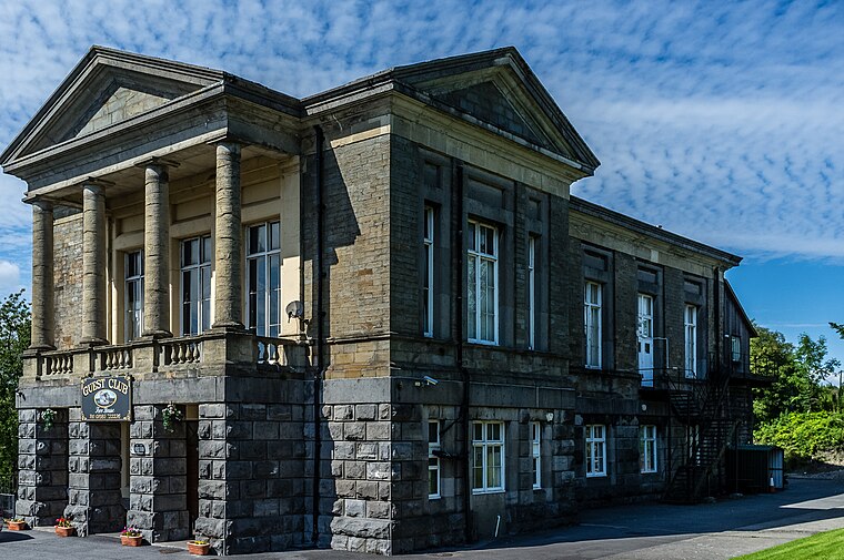
Photo: Varitek, CC BY-SA 3.0.
Dowlais is a village and community of the county borough of Merthyr Tydfil, in South Wales. The name is derived from the Welsh du meaning 'black' and glais meaning 'stream'.
Pant
Village

Photo: John Lord, CC BY-SA 2.0.
Pant is a village and community on the outskirts of Merthyr Tydfil, a large former mining town in the South Wales Valleys, Wales. Pant is notable for being the starting point of the Brecon Mountain Railway, and the site of the former Morlais railway tunnel, which runs underneath the village and emerges in the middle of it.
Gurnos
Suburb

Photo: Hywel Williams, CC BY-SA 2.0.
Gurnos is a community of Merthyr Tydfil County Borough in Wales, United Kingdom. It consists principally of the Gurnos Estate. The population in 2011 was 5,280.
Dowlais Bruce Hotel
- Type: Bus stop
- Category: transportation
- Location: Dowlais, Merthyr Tydfil, Wales, United Kingdom, Britain and Ireland, Europe
- View on OpenStreetMap
Latitude
51.76352° or 51° 45′ 49″ northLongitude
-3.35658° or 3° 21′ 24″ westOpen location code
9C3RQJ7V+C9OpenStreetMap ID
node 9174254958OpenStreetMap feature
highway=bus_stopOpenStreetMap feature
public_transport=platform
This page is based on OpenStreetMap, Wikidata, and Wikimedia Commons.
We’d love your help improving our open data sources. Thank you for contributing.
Satellite Map
Discover Dowlais Bruce Hotel from above in high-definition satellite imagery.
Notable Places Nearby
Highlights include Dowlais Police Station and Ivor English Congregational Church.
Nearby Places
Explore places such as The Tea Cosy and Furnace Fryers.
Wales: Must-Visit Destinations
Delve into Cardiff, Swansea, Llanfairpwllgwyngyll, and Newport.
Curious Bus Stops to Discover
Uncover intriguing bus stops from every corner of the globe.
About Mapcarta. Data © OpenStreetMap contributors and available under the Open Database License". Text is available under the CC BY-SA 4.0 license, except for photos, directions, and the map. Photo: fionamcallisterphotography, CC BY 2.0.