Fašistično taborišče
Fašistično taborišče is a memorial in Municipality of Preko, Zadar County. Fašistično taborišče is situated nearby to the church Sv. Marija, as well as near the village Ošljak, Preko.| Tap on a place to explore it |
Places of Interest Nearby
Highlights include Ošljak and Galovac.
Ošljak
Island
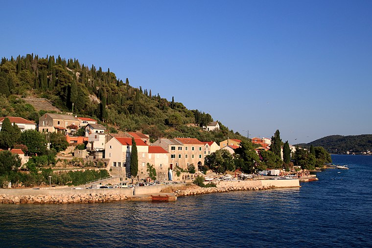
Photo: Lovro Rumiha, CC BY 2.0.
Ošljak is a Croatian island in the Adriatic Sea. Its total area is 0.3 km2 and it lies just off the Dalmatian coast between Zadar and the island of Ugljan.
Galovac
Islet

Photo: AleXXw, CC BY-SA 3.0.
Galovac is an islet, which is situated 1½ km northwest of Fašistično taborišče.
St. Michael Fort

Photo: Jean-no, CC BY-SA 3.0.
Fort St. Michael is a fortress on the island of Ugljan, in northern Dalmatia, Croatia. It was initially built by the Byzantine Empire in the 6th century, and rebuilt by the Republic of Venice in 1202, during the Fourth Crusade. St. Michael Fort is situated 4 km west of Fašistično taborišče.
Places in the Area
Nearby places include Ošljak, Preko and Preko.
Preko
Village

Photo: Andres rus, CC BY-SA 3.0.
Preko is a village and a municipality in Zadar County, Croatia. It is situated, as the name suggests, opposite of Zadar, on the island of Ugljan, in northern Dalmatia.
Kali
Village

Photo: Jean-no, CC BY-SA 3.0.
Kali is a village and the only settlement in the eponymous municipality in Croatia on Ugljan island in Zadar County. In the 2011 census, there were 1,638 inhabitants, 99.39% of whom were Croats.
Fašistično taborišče
- Type: Memorial
- Category: historic site
- Location: Municipality of Preko, Zadar County, Croatia, Balkans, Europe
- View on OpenStreetMap
Latitude
44.07837° or 44° 4′ 42″ northLongitude
15.20692° or 15° 12′ 25″ eastOpen location code
8FPQ36H4+8QOpenStreetMap ID
node 9199983270OpenStreetMap feature
historic=memorial
This page is based on OpenStreetMap, Wikidata, and Wikimedia Commons.
We’d love your help improving our open data sources. Thank you for contributing.
Satellite Map
Discover Fašistično taborišče from above in high-definition satellite imagery.
Notable Places Nearby
Highlights include Sv. Marija and Preko.
Nearby Places
Explore places such as Copulo and Lazaret.
Croatia: Must-Visit Destinations
Delve into Zagreb, Dubrovnik, Split, and Rijeka.
Curious Memorials to Discover
Uncover intriguing memorials from every corner of the globe.
About Mapcarta. Data © OpenStreetMap contributors and available under the Open Database License". Text is available under the CC BY-SA 4.0 license, except for photos, directions, and the map. Photo: Wikimedia, CC BY-SA 3.0.