Meriwether Park
Meriwether Park is a neighborhood in Lynchburg, Central Virginia, Virginia. Meriwether Park is situated nearby to the neighborhood Royal Oaks, as well as near Irvington Springs.| Tap on a place to explore it |
Places of Interest
Highlights include James River Day School.
James River Day School
School
James River Day School, or JRDS, is an independent, co-educational, non-sectarian K-8 day school in Lynchburg, Virginia. JRDS serves academically qualified students in Kindergarten through 8th Grade, regardless of race, color, national origin, ethnic, social, or economic background.
Places in the Area
Nearby places include Brandywine and Elon.
Brandywine
Hamlet
Brandywine is an unincorporated community in Caroline County, in the U.S. state of Virginia. Brandywine is situated 5 miles northeast of Meriwether Park.
Elon
Village
Elon is an unincorporated community in Amherst County, Virginia, United States. The community is located along Virginia State Route 130, northwest of Lynchburg. It is part of the Lynchburg Metropolitan Statistical Area. Elon is situated 5 miles northeast of Meriwether Park.
Kemper Street Industrial Historic District
Neighborhood
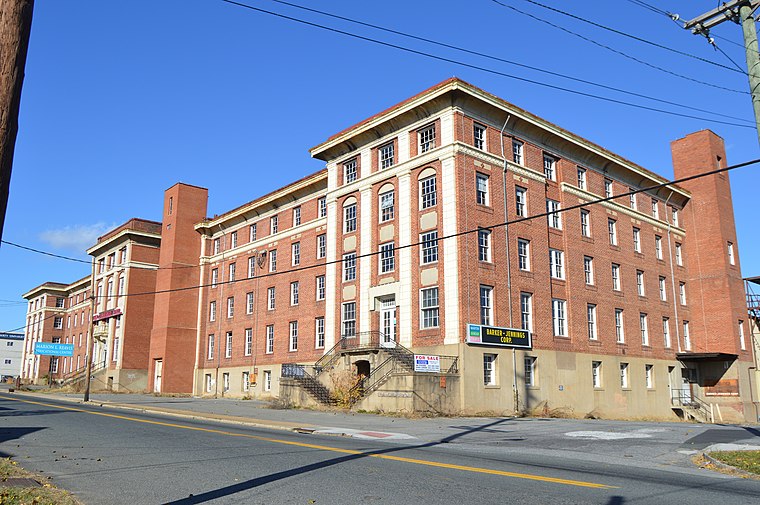
Photo: Nyttend, Public domain.
The Kemper Street Industrial Historic District encompasses a collection of industrial sites on Campbell Avenue and Kemper Street in Lynchburg, Virginia. Kemper Street Industrial Historic District is situated 5 miles southeast of Meriwether Park.
Meriwether Park
- Type: Neighborhood
- Category: locality
- Location: Lynchburg, Central Virginia, Virginia, South, United States, North America
- View on OpenStreetMap
Latitude
37.44783° or 37° 26′ 52″ northLongitude
-79.23193° or 79° 13′ 55″ westOpen location code
8792CQX9+46OpenStreetMap ID
node 9233967983OpenStreetMap feature
place=neighbourhood
This page is based on OpenStreetMap, Wikidata, and Wikimedia Commons.
We’d love your help improving our open data sources. Thank you for contributing.
Satellite Map
Discover Meriwether Park from above in high-definition satellite imagery.
Places with the Same Name
Discover other places named “Meriwether Park”.
Localities in the Area
Explore places such as Royal Oaks and Irvington Springs.
Notable Places Nearby
Highlights include Seven Hills Dance Studio and Findings.
Central Virginia: Must-Visit Destinations
Delve into Richmond, Charlottesville, Petersburg, and Danville.
Curious Neighborhoods to Discover
Uncover intriguing neighborhoods from every corner of the globe.
About Mapcarta. Data © OpenStreetMap contributors and available under the Open Database License". Text is available under the CC BY-SA 4.0 license, except for photos, directions, and the map. Photo: Wikimedia, CC0.