Hillcrest Crafts
Hillcrest Crafts is a blacksmith in East Layton, Richmondshire District, England. Hillcrest Crafts is situated nearby to Miniature World Riding Academy, as well as near Christ Church.| Tap on a place to explore it |
Places of Interest Nearby
Highlights include Christ Church and Stanwick Iron Age Fortifications.
Christ Church
Church

Photo: Andy Waddington, CC BY-SA 2.0.
Christ Church is an Anglican church in East Layton, a village in North Yorkshire, in England. A chapel in East Layton was first recorded in 1619. The current building was constructed in 1895, commissioned by Mrs Maynard Proud, and is still owned by her family trust. Christ Church is situated 2,700 feet northwest of Hillcrest Crafts.
Stanwick Iron Age Fortifications
Archaeological site

Photo: Lizzyp, Public domain.
The Stanwick Iron Age Fortifications, a huge Iron Age hill fort, sometimes but not always considered an oppidum, comprising over 9 kilometres of ditches and ramparts enclosing approximately 300 hectares of land, are situated in Richmondshire, North Yorkshire, England. Stanwick Iron Age Fortifications is situated 1½ miles northeast of Hillcrest Crafts.
St John the Baptist’s Church, Stanwick
Church

Photo: Hugh Mortimer, CC BY-SA 2.0.
St John the Baptist's Church is a redundant Anglican church in the village of Stanwick St John, North Yorkshire, England. It is recorded in the National Heritage List for England as a designated Grade I listed building, and is under the care of the Churches Conservation Trust. St John the Baptist’s Church, Stanwick is situated 2 miles northeast of Hillcrest Crafts.
Places in the Area
Nearby places include Hartforth and Aldbrough St John.
Hartforth
Locality
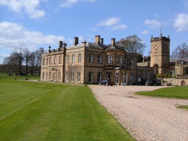
Photo: Roger Dean, CC BY-SA 2.0.
Hartforth is a small village in the county of North Yorkshire, England. The village is situated approximately 9 miles south-west from the market town of Darlington, and is part of the civil parish of Gilling with Hartforth and Sedbury. Hartforth is situated 2 miles south of Hillcrest Crafts.
Aldbrough St John
Village

Photo: Wikimedia, CC BY-SA 2.0.
Aldbrough St John is a village and civil parish in North Yorkshire, England. The parish has a population of 325, increasing to 392 at the 2011 Census. From 1974 to 2023 it was part of the district of Richmondshire, it is now administered by the unitary North Yorkshire Council. Aldbrough St John is situated 2½ miles northeast of Hillcrest Crafts.
Gilling West
Village
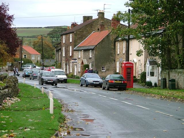
Photo: Mick Garratt, CC BY-SA 2.0.
Gilling West is a village about 3.5 miles north of Richmond in North Yorkshire, England. It is located in the civil parish of Gilling with Hartforth and Sedbury. Gilling West is situated 2½ miles south of Hillcrest Crafts.
Hillcrest Crafts
- Type: Blacksmith
- Category: workshop
- Location: East Layton, Richmondshire District, North Yorkshire, Yorkshire, England, United Kingdom, Britain and Ireland, Europe
- View on OpenStreetMap
Latitude
54.47909° or 54° 28′ 45″ northLongitude
-1.73868° or 1° 44′ 19″ westOpen location code
9C6WF7H6+JGOpenStreetMap ID
node 9312233089OpenStreetMap feature
craft=blacksmith
This page is based on OpenStreetMap, Wikidata, and Wikimedia Commons.
We’d love your help improving our open data sources. Thank you for contributing.
Satellite Map
Discover Hillcrest Crafts from above in high-definition satellite imagery.
Notable Places Nearby
Highlights include Miniature World Riding Academy and Middle Plantation.
Nearby Places
Explore places such as East Layton STW and Carkin Moor Farm.
North Yorkshire: Must-Visit Destinations
Delve into York, Middlesbrough, Harrogate, and Ripon.
Curious Blacksmiths to Discover
Uncover intriguing blacksmiths from every corner of the globe.
About Mapcarta. Data © OpenStreetMap contributors and available under the Open Database License". Text is available under the CC BY-SA 4.0 license, except for photos, directions, and the map. Photo: Michael Bryan, CC BY 2.0.