Food of Peking
Food of Peking is a fast food restaurant in Enfield, Greater London, England which is located on Alderman’s Hill. Food of Peking is situated nearby to Palmers Green railway station, as well as near Park View Health Clubs.| Tap on a place to explore it |
- Type: Fast food restaurant
- Cuisine: Chinese
- Address: 20 Alderman’s Hill
Places of Interest Nearby
Highlights include Palmers Green railway station and St Anne’s Catholic High School.
Palmers Green railway station
Railway station
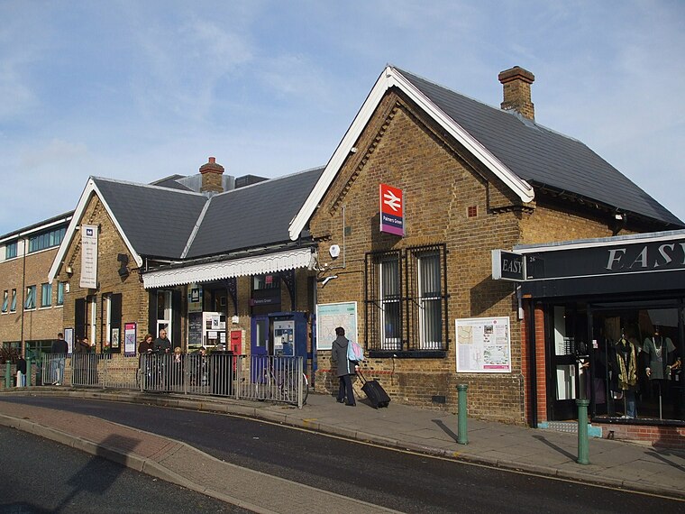
Photo: Sunil060902, CC BY-SA 3.0.
Palmers Green railway station, in Aldermans Hill, is a train station in the London Borough of Enfield in north London, located within London fare zone 4.
St Anne’s Catholic High School
School
St Anne's Catholic High School for Girls is an all-girls Catholic secondary school located in London, England, which was founded to provide education for Catholic girls aged 11–18. St Anne’s Catholic High School is situated 900 feet southeast of Food of Peking.
Broomfield Park
Park

Photo: Dudley Miles, CC BY-SA 3.0.
Broomfield Park is a 21 hectare public park in Palmers Green in the London Borough of Enfield. It is a Site of Local Importance for Nature Conservation and is registered by English Heritage in the Register of Historic Parks and Gardens for its special historic interest… Broomfield Park is situated 1,700 feet west of Food of Peking.
Places in the Area
Nearby places include Palmers Green and Bowes Park.
Palmers Green
Suburb

Photo: John Salmon, CC BY-SA 2.0.
Palmers Green is a suburban area in north London, England, within the London Borough of Enfield. It is located within the N13 postcode district, around 8 miles north of Charing Cross.
Bowes Park
Quarter
Photo: Mcsony, CC BY-SA 3.0.
Bowes Park is situated on the borders of Wood Green, Palmers Green and Bounds Green in London, England. The postcodes for Bowes Park are N11, N13 and N22.
Winchmore Hill
Quarter
Winchmore Hill is a suburb in the London Borough of Enfield, north London, England, in the N21 postal district. The Winchmore Hill conservation area serves as the focal point of the district.
Food of Peking
- Categories: food and restaurant
- Location: Enfield, Greater London, England, United Kingdom, Britain and Ireland, Europe
- View on OpenStreetMap
Latitude
51.61815° or 51° 37′ 5″ northLongitude
-0.11017° or 0° 6′ 37″ westOpen location code
9C3XJV9Q+7WOpenStreetMap ID
node 9349272586OpenStreetMap feature
amenity=fast_foodOpenStreetMap attribute
cuisine=chinese
This page is based on OpenStreetMap, Wikidata, and Wikimedia Commons.
We’d love your help improving our open data sources. Thank you for contributing.
Satellite Map
Discover Food of Peking from above in high-definition satellite imagery.
Notable Places Nearby
Highlights include Park View Health Clubs and The Alfred Herring.
Nearby Places
Explore places such as Baker and Chase and Hill Top.
England: Must-Visit Destinations
Delve into London, Manchester, Sheffield, and Leeds.
Curious Fast Food Restaurants to Discover
Uncover intriguing fast food restaurants from every corner of the globe.
About Mapcarta. Data © OpenStreetMap contributors and available under the Open Database License". Text is available under the CC BY-SA 4.0 license, except for photos, directions, and the map. Photo: sidibousaid, CC BY 2.0.