Extremadura 11
Extremadura 11 is a café in Gijón, Asturias. Extremadura 11 is situated nearby to the suburb Pumarín, as well as near the sports venue Pabellón C.M.I. Gijon Sur.| Tap on a place to explore it |
Places of Interest Nearby
Highlights include Gijón Railway Station and Sanctuary of Nuestra Señora de Contrueces.
Gijón Railway Station
Railway station
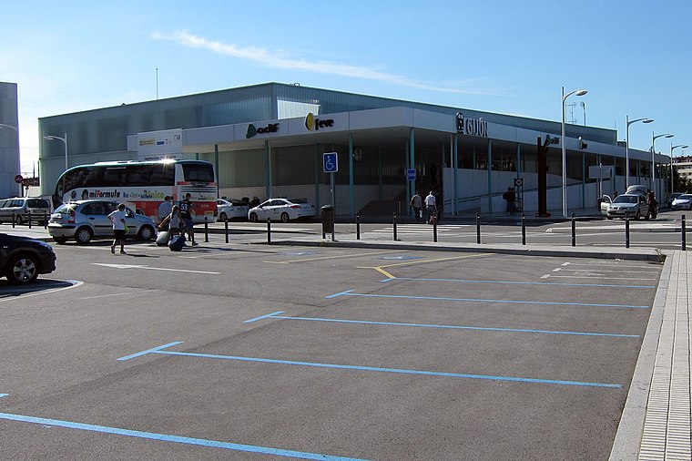
Photo: FDV, CC BY-SA 3.0.
Gijón Railway Station, also known as Gijón Sanz Crespo, is the main railway station of Gijón, Spain. Since 2011 it is located in Sanz Crespo street due to the works for the Metrotrén Asturias project. Gijón Railway Station is situated 1½ km north of Extremadura 11.
Sanctuary of Nuestra Señora de Contrueces
Manor estate

Photo: Adolfobrigido, CC BY-SA 3.0.
The Sanctuary of Our Lady of Contrueces is a Catholic church located in the autonomous community of Asturias, in the southern part of the urban area of Gijón, within the neighborhood of Contrueces. Sanctuary of Nuestra Señora de Contrueces is situated 1¼ km southeast of Extremadura 11.
Palacio de San Andrés de Cornellana
Manor estate
 Palacio de San Andrés de Cornellana is a manor estate, which is situated 1 km southeast of Extremadura 11.
Places in the Area
Nearby places include Pumarín and Montevil.


Extremadura 11
- Type: Café
- Location: Gijón, Asturias, Green Spain, Spain, Iberia, Europe
- View on OpenStreetMap
Latitude
43.52474° or 43° 31′ 29″ northLongitude
-5.67398° or 5° 40′ 26″ westOpen location code
8CMPG8FG+VCOpenStreetMap ID
node 9364121350OpenStreetMap feature
amenity=cafe
This page is based on OpenStreetMap, Wikidata, and Wikimedia Commons.
We’d love your help improving our open data sources. Thank you for contributing.
Satellite Map
Discover Extremadura 11 from above in high-definition satellite imagery.
Notable Places Nearby
Highlights include Pista polideportiva de Pumarin and Espacio Escénico El Huerto.
Nearby Places
Explore places such as Anna Nava and La Calle.
Asturias: Must-Visit Destinations
Delve into Oviedo, Aviles, Villaviciosa, and Grado.
Curious Cafés to Discover
Uncover intriguing cafés from every corner of the globe.
About Mapcarta. Data © OpenStreetMap contributors and available under the Open Database License". Text is available under the CC BY-SA 4.0 license, except for photos, directions, and the map. Photo: charles lecompte, CC BY-SA 3.0.