Point Chô
Point Chô is a restaurant in Terre-de-Haut, Arrondissement de la Basse-Terre. Point Chô is situated nearby to Place du Gouverneur du Lion, as well as near the pier Port du Mouillage.| Tap on a place to explore it |
Places of Interest Nearby
Highlights include Notre Dame de l’Assomption, les Saintes and Les Saintes Airport.
Notre Dame de l’Assomption, les Saintes
Church

Photo: UHF, CC BY-SA 3.0.
Notre-Dame de l'Assomption is a Roman Catholic Church of the Îles des Saintes, an island in the archipelago of the French Overseas department of Guadeloupe. Notre Dame de l’Assomption, les Saintes is situated 110 metres south of Point Chô.
Les Saintes Airport
Aerodrome
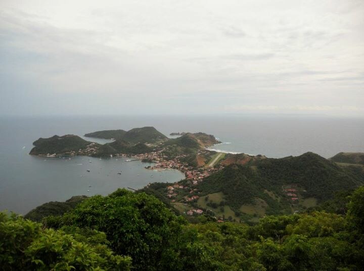
Photo: Moowgly, CC BY-SA 3.0.
Les Saintes Airport is an airport serving the archipelago of Îles des Saintes, French West Indies. It is on an isthmus in the middle of Terre-de-Haut Island, a dependency of Guadeloupe. A special pilot license endorsement is required to land here.
Fort Napoléon des Saintes
Fort

Photo: Gauthier Geoffroy, CC BY-SA 4.0.
Fort Napoléon is a fortification, located on Terre-de-Haut Island, in the Îles des Saintes, Guadeloupe. Property of the Departmental Council of Guadeloupe, it has been classified as a historical monument since the December 15, 1997. Fort Napoléon des Saintes is situated 780 metres north of Point Chô.
Places in the Area
Nearby places include La Savane and Grande-Anse.
La Savane
Neighborhood
La Savane is a quartier of Terre-de-Haut Island, located in Îles des Saintes archipelago in the Caribbean. It is a residential area located in the central part of the island.
Grande-Anse
Neighborhood

Photo: Patrice78500, CC BY-SA 3.0.
Grande-Anse is a quartier of Terre-de-Haut Island, located in Îles des Saintes archipelago in the Caribbean. It is located in the eastern part of the island.
Point Chô
- Type: Restaurant
- Cuisine: sandwich
- Category: food
- Location: Terre-de-Haut, Arrondissement de la Basse-Terre, Guadeloupe, Lesser Antilles, Caribbean, North America
- View on OpenStreetMap
Latitude
15.86829° or 15° 52′ 6″ northLongitude
-61.58235° or 61° 34′ 57″ westOpen location code
777WVC99+83OpenStreetMap ID
node 9382261383OpenStreetMap feature
amenity=restaurantOpenStreetMap attribute
cuisine=sandwich
This page is based on OpenStreetMap, Wikidata, and Wikimedia Commons.
We’d love your help improving our open data sources. Thank you for contributing.
Satellite Map
Discover Point Chô from above in high-definition satellite imagery.
Notable Places Nearby
Highlights include Place du Gouverneur du Lion and Port du Mouillage.
Nearby Places
Explore places such as Paradis and Marianne.
Guadeloupe: Must-Visit Destinations
Delve into Pointe-à-Pitre, Sainte-Anne, Basse-Terre, and Grande-Terre.
Curious Restaurants to Discover
Uncover intriguing restaurants from every corner of the globe.
About Mapcarta. Data © OpenStreetMap contributors and available under the Open Database License". Text is available under the CC BY-SA 4.0 license, except for photos, directions, and the map. Photo: Patrice78500, CC BY-SA 3.0.