Wager Warenhandel Gerlejn
Wager Warenhandel Gerlejn is a second-hand shop in Linz am Rhein, Neuwied, Rhineland-Palatinate. Wager Warenhandel Gerlejn is situated nearby to Klosterstraße, as well as near the church Servitessenkirche.| Tap on a place to explore it |
- Opening hours: Monday—Saturday 10:00 AM—6:00 PM
- Email: wager19@web.de
- Type: Second-hand shop
Places of Interest Nearby
Highlights include Neutor and Servitessenkirche.
Neutor
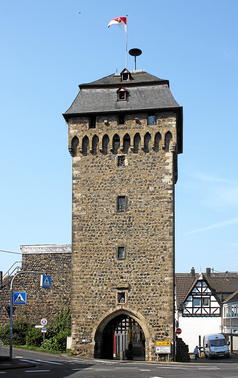
Photo: Beckstet, CC BY-SA 3.0.
Neutor is situated 110 metres northeast of Wager Warenhandel Gerlejn.

St. Martin
Church

Photo: Tohma, CC BY-SA 4.0.
St. Martin is a church, which is situated 170 metres south of Wager Warenhandel Gerlejn.
Places in the Area
Nearby places include Kripp and Ockenfels.

Ockenfels
Village

Photo: Tohma, CC BY-SA 4.0.
Ockenfels is a municipality in the district of Neuwied, in Rhineland-Palatinate, Germany. Ockenfels lies in the Rhine-Westerwald Nature Park in the North of Rhineland-Palatinate. The municipality was founded in 13th century.
Dattenberg
Village

Photo: Wolkenkratzer, CC BY-SA 4.0.
Dattenberg is a municipality in the district of Neuwied, in Rhineland-Palatinate, Germany.
Wager Warenhandel Gerlejn
- Category: shop
- Location: Linz am Rhein, Neuwied, Rhineland-Palatinate, Germany, Central Europe, Europe
- View on OpenStreetMap
Latitude
50.56743° or 50° 34′ 3″ northLongitude
7.28339° or 7° 17′ 0″ eastOpen location code
9F29H78M+X9OpenStreetMap ID
node 9431200840OpenStreetMap feature
shop=second_hand
This page is based on OpenStreetMap, Wikidata, and Wikimedia Commons.
We’d love your help improving our open data sources. Thank you for contributing.
Satellite Map
Discover Wager Warenhandel Gerlejn from above in high-definition satellite imagery.
Notable Places Nearby
Highlights include Klosterstraße and Dr.-Siegmund-Wolf-Platz.
Nearby Places
Explore places such as Dina Wallach and Kiana.
Rhineland-Palatinate: Must-Visit Destinations
Delve into Mainz, Trier, Koblenz, and Worms.
Curious Second-Hand Shops to Discover
Uncover intriguing second-hand shops from every corner of the globe.
About Mapcarta. Data © OpenStreetMap contributors and available under the Open Database License". Text is available under the CC BY-SA 4.0 license, except for photos, directions, and the map. Photo: Traveler100, CC BY-SA 3.0.