Wanderparadies Königswarte
Wanderparadies Königswarte is in Berg, Bruck an der Leitha District, Lower Austria. Wanderparadies Königswarte is situated nearby to Cemetery Berg, as well as near the pitch SF Berg.| Tap on a place to explore it |
Places of Interest Nearby
Highlights include Hindlerberg and Aussichtsturm Königswarte.

Aussichtsturm Königswarte
Scenic viewpoint

Photo: Bwag, CC BY-SA 4.0.
Aussichtsturm Königswarte is a scenic viewpoint, which is situated 1 km north of Wanderparadies Königswarte.
Pottenburg
Castle

Photo: Doronenko, CC BY-SA 3.0 at.
Pottenburg is a castle, which is situated 1½ km north of Wanderparadies Königswarte.
Places in the Area
Nearby places include Edelstal and Dlhé diely.
Edelstal
Village

Photo: Bwag, CC BY-SA 4.0.
Edelstal is a township in the district of Neusiedl am See, in the Austrian state of Burgenland. Edelstal is situated 2½ km west of Wanderparadies Königswarte.
Dlhé diely
Quarter
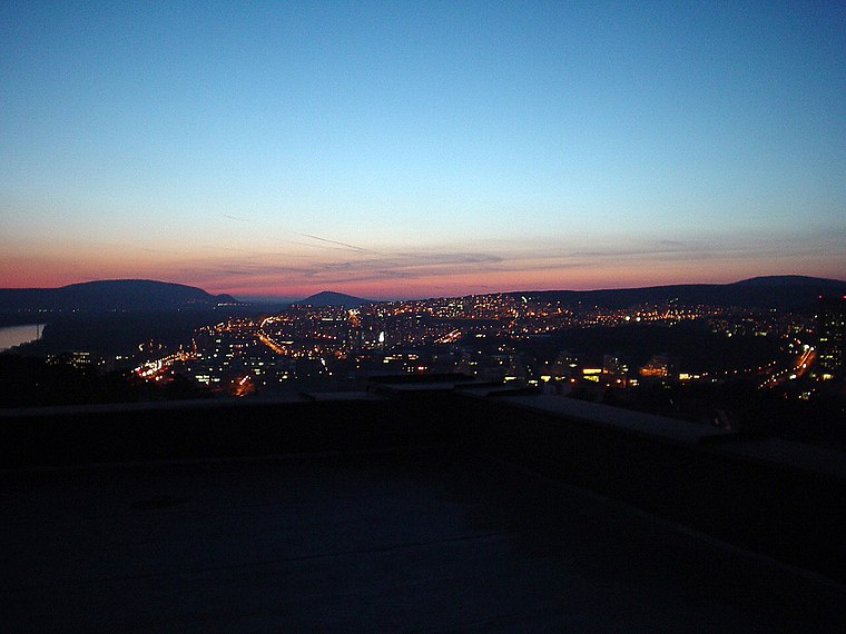
Photo: Wikimedia, Public domain.
Template:Geobox Dlhé diely is a neighborhood in the borough of Karlova Ves, Bratislava. Dlhé diely is situated 5 km northeast of Wanderparadies Königswarte.
Prellenkirchen
Village
Prellenkirchen is a town in the district of Bruck an der Leitha in Lower Austria in Austria. Prellenkirchen is situated 6 km southwest of Wanderparadies Königswarte.
Wanderparadies Königswarte
- Type: Sign
- Categories: information and tourism
- Location: Berg, Bruck an der Leitha District, Lower Austria, Austria, Central Europe, Europe
- View on OpenStreetMap
Latitude
48.10638° or 48° 6′ 23″ northLongitude
17.02317° or 17° 1′ 23″ eastOpen location code
8FWV424F+H7OpenStreetMap ID
node 9455346738OpenStreetMap feature
tourism=information
This page is based on OpenStreetMap, Wikidata, and Wikimedia Commons.
We’d love your help improving our open data sources. Thank you for contributing.
Satellite Map
Discover Wanderparadies Königswarte from above in high-definition satellite imagery.
Notable Places Nearby
Highlights include Cemetery Berg and SF Berg.
Nearby Places
Explore places such as Weinlehrpfad Berg and Berg bei Wolfsthal Friedhofgasse.
Lower Austria: Must-Visit Destinations
Delve into St. Pölten, Wiener Neustadt, Amstetten, and Klosterneuburg.
Curious Places to Discover
Uncover intriguing places from every corner of the globe.
About Mapcarta. Data © OpenStreetMap contributors and available under the Open Database License". Text is available under the CC BY-SA 4.0 license, except for photos, directions, and the map. Photo: Lonezor, CC BY-SA 3.0.