Hartbergerkreuz
Hartbergerkreuz is a wayside cross in Bad Fischau-Brunn, Wiener Neustadt District, Lower Austria. Hartbergerkreuz is situated nearby to the peak Moosbügel, as well as near the cave untere Auriegelhöhle.| Tap on a place to explore it |
Places of Interest Nearby
Highlights include Pfaffenkogel and Burgruine Starhemberg.

Burgruine Starhemberg
Castle
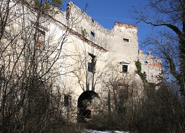
Photo: Bwag, CC BY-SA 3.0.
Burgruine Starhemberg was a castle in Lower Austria, Austria. Built in the 1140s, the castle fell into ruins by the late 19th century. Burgruine Starhemberg is 520 metres above sea level. Burgruine Starhemberg is situated 3 km northwest of Hartbergerkreuz.
Saint Leonard Church
Church

Photo: Karl Gruber, CC BY-SA 3.0.
Saint Leonard Church is situated 2 km north of Hartbergerkreuz.
Places in the Area
Nearby places include Villenkolonie, Wöllersdorf and Alkersdorf.
Villenkolonie, Wöllersdorf
Hamlet

Photo: Wolfgang glock, CC BY-SA 3.0.
Villenkolonie, Wöllersdorf is a hamlet, which is situated 4 km east of Hartbergerkreuz.
Alkersdorf
Hamlet

Photo: Braveheart, CC BY-SA 4.0.
Alkersdorf is a hamlet, which is situated 4½ km northwest of Hartbergerkreuz.
Hölles
Village

Photo: Petwoe, CC BY-SA 4.0.
Hölles is a village, which is situated 7 km northeast of Hartbergerkreuz.
Hartbergerkreuz
- Type: Wayside cross
- Category: historic site
- Location: Bad Fischau-Brunn, Wiener Neustadt District, Lower Austria, Austria, Central Europe, Europe
- View on OpenStreetMap
Latitude
47.85295° or 47° 51′ 11″ northLongitude
16.13082° or 16° 7′ 51″ eastInception
2007Open location code
8FVRV43J+58OpenStreetMap ID
node 946439312OpenStreetMap feature
historic=wayside_cross
This page is based on OpenStreetMap, Wikidata, and Wikimedia Commons.
We’d love your help improving our open data sources. Thank you for contributing.
Satellite Map
Discover Hartbergerkreuz from above in high-definition satellite imagery.
Notable Places Nearby
Highlights include Moosbügel and untere Auriegelhöhle.
Nearby Places
Explore places such as Hansl-Stollen and Hubertuskreuz.
Lower Austria: Must-Visit Destinations
Delve into St. Pölten, Wiener Neustadt, Amstetten, and Klosterneuburg.
Curious Wayside Crosses to Discover
Uncover intriguing wayside crosses from every corner of the globe.
About Mapcarta. Data © OpenStreetMap contributors and available under the Open Database License". Text is available under the CC BY-SA 4.0 license, except for photos, directions, and the map. Photo: Lonezor, CC BY-SA 3.0.