Windmill Road South
Windmill Road South is a bus stop in Dacorum District, Hertfordshire, England. Windmill Road South is situated nearby to the playground Tree Swing, as well as near the school Broadfield Academy.| Tap on a place to explore it |
Places of Interest Nearby
Highlights include St Barnabas and Adeyfield Academy.
St Barnabas
Church

Photo: Nigel Cox, CC BY-SA 2.0.
St Barnabas is a church, which is situated 1,900 feet northeast of Windmill Road South.
Adeyfield Academy
School

Photo: Jack Hill, CC BY-SA 2.0.
The Adeyfield Academy is an 11–18 mixed, secondary school and sixth form with academy status in Adeyfield, Hemel Hempstead, Hertfordshire, England. It is part of the Atlas Multi Academy Trust. Adeyfield Academy is situated 1,900 feet east of Windmill Road South.
Hemel Hempstead Hospital
Hospital
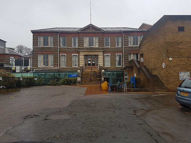
Photo: Dormskirk, CC BY-SA 3.0.
Hemel Hempstead Hospital is an acute District General Hospital in Hemel Hempstead, Hertfordshire operated by the West Hertfordshire Teaching Hospitals NHS Trust. Hemel Hempstead Hospital is situated 3,200 feet west of Windmill Road South.
Places in the Area
Nearby places include Adeyfield and Bennetts End.
Adeyfield
Suburb

Photo: Wikimedia, CC BY-SA 2.0.
Adeyfield was the first planned neighbourhood to be built in the postwar new town expansion of Hemel Hempstead, in the English county of Hertfordshire.
Bennetts End
Suburb

Photo: Nigel Cox, CC BY-SA 2.0.
Bennetts End is a neighbourhood within Hemel Hempstead in Hertfordshire, England. It is located in the southeast of the town and consists almost entirely of public housing built as part of the new town in the 1950s.
Hemel Hempstead

Photo: ZIGGY RADWA, CC BY-SA 3.0.
Hemel Hempstead is a town in the Dacorum district in Hertfordshire, England. It is located 24 miles north-west of London; nearby towns and cities include Watford, St Albans and Berkhamsted.
Windmill Road South
- Type: Bus stop
- Category: transportation
- Location: Dacorum District, Hertfordshire, East of England, England, United Kingdom, Britain and Ireland, Europe
- View on OpenStreetMap
Latitude
51.75133° or 51° 45′ 5″ northLongitude
-0.45553° or 0° 27′ 20″ westOpen location code
9C3XQG2V+GQOpenStreetMap ID
node 9528370009OpenStreetMap feature
highway=bus_stopOpenStreetMap feature
public_transport=platform
This page is based on OpenStreetMap, Wikidata, and Wikimedia Commons.
We’d love your help improving our open data sources. Thank you for contributing.
Satellite Map
Discover Windmill Road South from above in high-definition satellite imagery.
Places with the Same Name
Discover other places named “Windmill Road South”.
Notable Places Nearby
Highlights include Tree Swing and Broadfield Academy.
Nearby Places
Explore places such as Sheepcote Road and Brick Cross.
Hertfordshire: Must-Visit Destinations
Delve into St Albans, Watford, Stevenage, and Hertford.
Curious Bus Stops to Discover
Uncover intriguing bus stops from every corner of the globe.
About Mapcarta. Data © OpenStreetMap contributors and available under the Open Database License". Text is available under the CC BY-SA 4.0 license, except for photos, directions, and the map. Photo: Wikimedia, CC0.