Maxx Photovoltaik
Maxx Photovoltaik is an office in Obritzberg-Rust, St. Pölten District, Lower Austria which is located on Witigaustraße. Maxx Photovoltaik is situated nearby to the post office Postpartner 3123, Marktgemeinde, as well as near the town hall Gemeindeamt Obritzberg-Rust.| Tap on a place to explore it |
Places of Interest Nearby
Highlights include Pfarrkirche Obritzberg and Barbarakreuz.
Pfarrkirche Obritzberg
Church
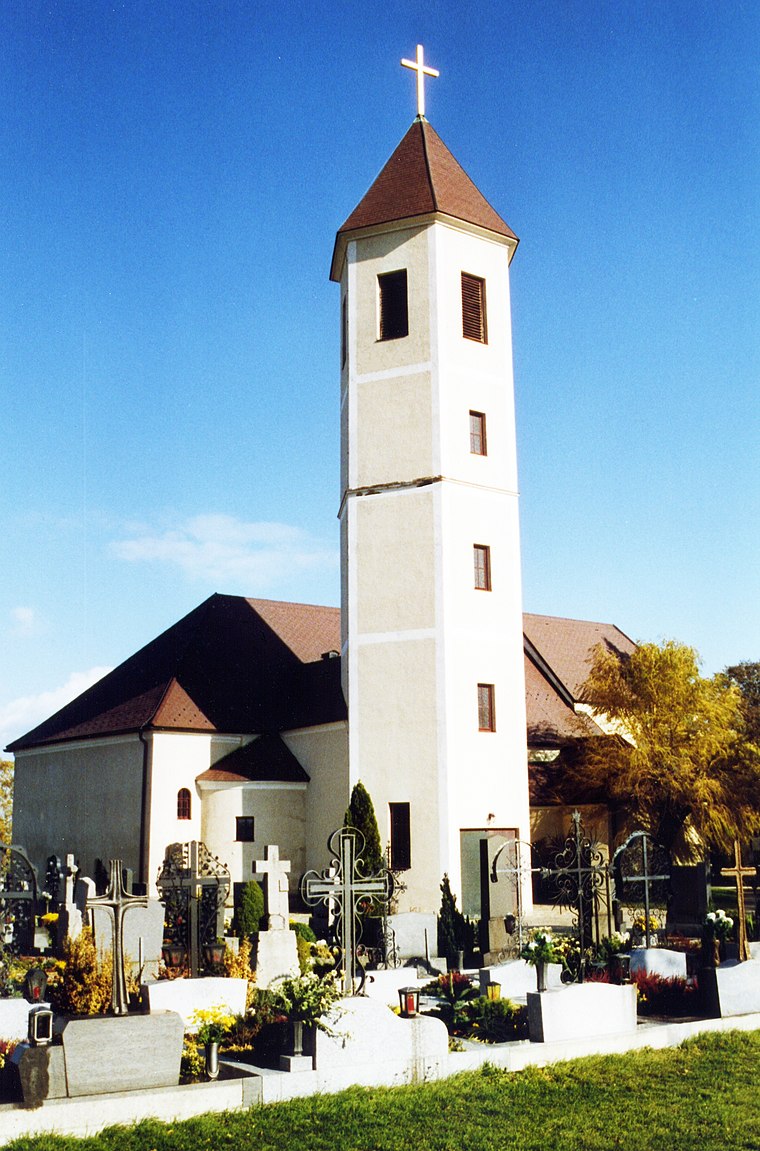 Pfarrkirche Obritzberg is a church, which is situated 1 km southeast of Maxx Photovoltaik.
Barbarakreuz
Wayside shrine

Photo: Schurdl, CC BY-SA 3.0 at.
Barbarakreuz is a wayside shrine, which is situated 1½ km north of Maxx Photovoltaik.
Höhensiedlung Singerkreuz
Archaeological site

Photo: F.Higer, CC BY-SA 3.0 at.
Höhensiedlung Singerkreuz is an archaeological site, which is situated 2½ km west of Maxx Photovoltaik.
Places in the Area
Nearby places include Fugging and Meidling.
Fugging
Village
 Fugging is a village in the municipality of Obritzberg-Rust, Sankt Pölten-Land, Austria. It is located in the state of Lower Austria and was known as Fucking until 1836. Fugging is situated 3½ km east of Maxx Photovoltaik.
Meidling
Village

Photo: Fotofriend, CC BY-SA 3.0 at.
Meidling is a village, which is situated 5 km northeast of Maxx Photovoltaik.

Maxx Photovoltaik
- Type: Business
- Address: Witigaustraße 11, Grünz, 3123
- Category: office
- Location: Obritzberg-Rust, St. Pölten District, Lower Austria, Austria, Central Europe, Europe
- View on OpenStreetMap
Latitude
48.29616° or 48° 17′ 46″ northLongitude
15.5868° or 15° 35′ 13″ eastOpen location code
8FWQ7HWP+FPOpenStreetMap ID
node 9565797795OpenStreetMap feature
office=company
This page is based on OpenStreetMap, Wikidata, and Wikimedia Commons.
We’d love your help improving our open data sources. Thank you for contributing.
Satellite Map
Discover Maxx Photovoltaik from above in high-definition satellite imagery.
Notable Places Nearby
Highlights include Gemeindeamt Obritzberg-Rust and Postpartner 3123, Marktgemeinde.
Nearby Places
Explore places such as SApro Handels GmbH and Grünz Witigaustraße.
Lower Austria: Must-Visit Destinations
Delve into St. Pölten, Wiener Neustadt, Amstetten, and Klosterneuburg.
Curious Places to Discover
Uncover intriguing places from every corner of the globe.
About Mapcarta. Data © OpenStreetMap contributors and available under the Open Database License". Text is available under the CC BY-SA 4.0 license, except for photos, directions, and the map. Photo: Lonezor, CC BY-SA 3.0.