Cedar Waxwing
Cedar Waxwing is a work of art in Williamsburg, Virginia. Cedar Waxwing is situated nearby to Galt Family Cemetery, as well as near Bicentennial Park.| Tap on a place to explore it |
Places of Interest Nearby
Highlights include Colonial Williamsburg and National Center for State Courts.
Colonial Williamsburg

Photo: ויקיג’אנקי, CC BY-SA 4.0.
Colonial Williamsburg is a "living-history museum" located in a historic district in Williamsburg, Virginia. Encompassing 301 acres, Colonial Williamsburg's Historic Area re-creates 18th-century Williamsburg as it appeared preceding and during the American Revolution.
National Center for State Courts
Building
The National Center for State Courts is an independent, non-profit organization focused on improving the administration of justice in the United States and around the world. National Center for State Courts is situated 480 feet south of Cedar Waxwing.
Governor’s Palace
Historic building
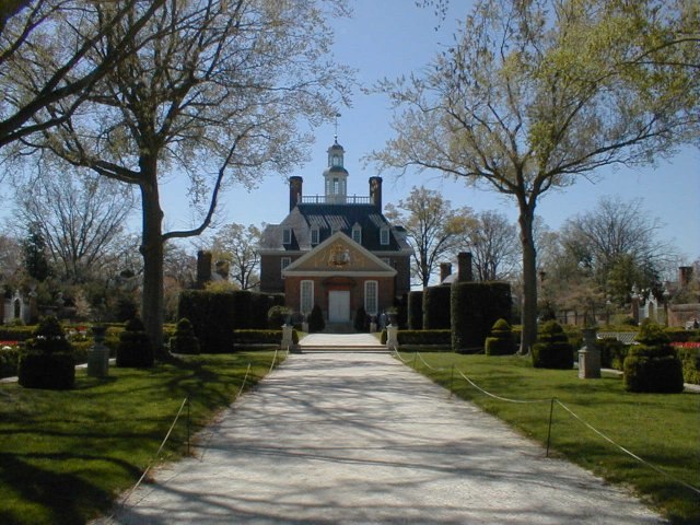
Photo: Agriculture, CC BY-SA 3.0.
The Governor's Palace in Williamsburg, Virginia, was the official residence of the royal governors of the Colony of Virginia. It was also a home for two of Virginia's post-colonial governors, Patrick Henry and Thomas Jefferson, until the capital was moved to Richmond in 1780, and with it the governor's residence. Governor’s Palace is situated 2,700 feet north of Cedar Waxwing.
Places in the Area
Nearby places include Ewell and Grove.
Ewell
Hamlet
Ewell was an unincorporated town in James City County west of Williamsburg, in the U.S. state of Virginia. Ewell was named for Benjamin Stoddert Ewell, who was a U.S. and Confederate army officer, and civil engineer. Ewell is situated 4½ miles northwest of Cedar Waxwing.
Grove
Hamlet

Photo: Wikimedia, CC BY-SA 3.0.
Grove is an unincorporated community in the southeastern portion of James City County in the Virginia Peninsula subregion of Virginia, United States. It is located in the center of the Historic Triangle of Colonial Virginia, communities linked by the Colonial Parkway. Grove is situated 5 miles southeast of Cedar Waxwing.
Jamestown
Locality

Photo: Ken Lund, CC BY-SA 2.0.
The Jamestown settlement in the Colony of Virginia was the first permanent English settlement in the Americas. It was located on the northeast bank of the James River, about 2.5 mi southwest of present-day Williamsburg. Jamestown is situated 6 miles southwest of Cedar Waxwing.
Cedar Waxwing
- Type: Work of art
- Artwork_type: sculpture
- Category: tourism
- Location: Williamsburg, Virginia, South, United States, North America
- View on OpenStreetMap
Latitude
37.26734° or 37° 16′ 2″ northLongitude
-76.70562° or 76° 42′ 20″ westOpen location code
8795778V+WQOpenStreetMap ID
node 9634468251OpenStreetMap feature
tourism=artworkOpenStreetMap attribute
artwork_type=sculpture
This page is based on OpenStreetMap, Wikidata, and Wikimedia Commons.
We’d love your help improving our open data sources. Thank you for contributing.
Satellite Map
Discover Cedar Waxwing from above in high-definition satellite imagery.
Notable Places Nearby
Highlights include Galt Family Cemetery and Bicentennial Park.
Nearby Places
Explore places such as Slice in Time and Galt.
Virginia: Must-Visit Destinations
Delve into Richmond, Arlington, Virginia Beach, and Norfolk.
Curious Work Of Arts to Discover
Uncover intriguing work of arts from every corner of the globe.
About Mapcarta. Data © OpenStreetMap contributors and available under the Open Database License". Text is available under the CC BY-SA 4.0 license, except for photos, directions, and the map. Photo: Humberto Moreno, CC BY 4.0.