Max-Oertz-Denkmal
Max-Oertz-Denkmal is a work of art in Neustadt in Holstein, Ostholstein, Schleswig-Holstein. Max-Oertz-Denkmal is situated nearby to the square Max-Oertz-Platz, as well as near the post office GLS PaketShop.| Tap on a place to explore it |
Places of Interest Nearby
Highlights include Hospitalkirche and Bird.
Hospitalkirche
Church

Photo: Hapebalf, CC BY-SA 3.0.
Hospitalkirche is a church, which is situated 120 metres west of Max-Oertz-Denkmal.

Stadtkirche Neustadt in Holstein
Church

Photo: Georg Karl Ell, CC BY-SA 4.0.
Stadtkirche Neustadt in Holstein is a church, which is situated 220 metres northeast of Max-Oertz-Denkmal.
Places in the Area
Nearby places include Neustadt in Holstein and Altenkrempe.
Neustadt in Holstein
Town

Photo: Peng, CC BY-SA 3.0.
Neustadt in Holstein is a town in the district of Ostholstein, in Schleswig-Holstein, Germany, on the Bay of Lübeck 30 km northeast of Lübeck, and 50 km southeast of Kiel.
Altenkrempe
Village
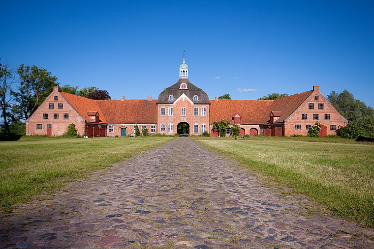
Photo: Sebfoto, CC BY-SA 3.0.
Altenkrempe is a municipality in the district of Ostholstein, in Schleswig-Holstein, Germany. Altenkrempe is situated 3 km north of Max-Oertz-Denkmal.
Pelzerhaken
Village

Photo: Michael Fiegle, CC BY-SA 4.0.
Pelzerhaken is a village, which is situated 3½ km southeast of Max-Oertz-Denkmal.
Max-Oertz-Denkmal
- Type: Work of art
- Artwork type: sculpture
- Category: tourism
- Location: Neustadt in Holstein, Ostholstein, Schleswig-Holstein, Germany, Central Europe, Europe
- View on OpenStreetMap
Latitude
54.10594° or 54° 6′ 21″ northLongitude
10.81125° or 10° 48′ 41″ eastOpen location code
9F6G4R46+9FOpenStreetMap ID
node 9651026354OpenStreetMap feature
tourism=artworkOpenStreetMap attribute
artwork_type=sculpture
This page is based on OpenStreetMap, Wikidata, and Wikimedia Commons.
We’d love your help improving our open data sources. Thank you for contributing.
Satellite Map
Discover Max-Oertz-Denkmal from above in high-definition satellite imagery.
Notable Places Nearby
Highlights include Max-Oertz-Platz and DPD PaketShop.
Nearby Places
Explore places such as Klüver’s Brauhaus and VinumCordes.
Schleswig-Holstein: Must-Visit Destinations
Delve into Kiel, Lübeck, Flensburg, and Heligoland.
Curious Work Of Arts to Discover
Uncover intriguing work of arts from every corner of the globe.
About Mapcarta. Data © OpenStreetMap contributors and available under the Open Database License". Text is available under the CC BY-SA 4.0 license, except for photos, directions, and the map. Photo: Ypsilon from Finland, CC0.