An der Elvekumer Sandkaule
An der Elvekumer Sandkaule is a locality in Neuss, Düsseldorf, North Rhine-Westphalia. An der Elvekumer Sandkaule is situated nearby to the locality Blechhecke, as well as near Kickelberg.| Tap on a place to explore it |
Places of Interest
Highlights include St. Aloysiuskapelle and Neuss Allerheiligen station.

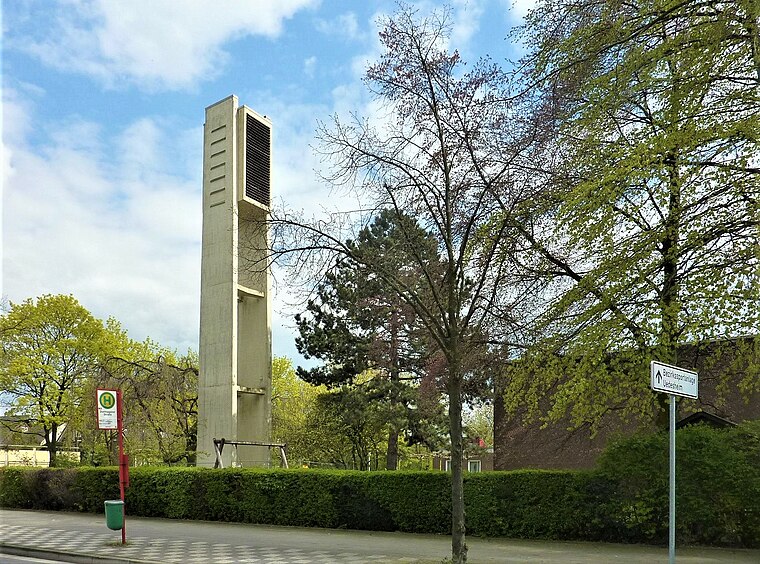
Neuss Allerheiligen station
Railway stop

Photo: A.Savin, CC BY-SA 3.0.
Neuss Allerheiligen station is a station in the city of Neuss in the German state of North Rhine-Westphalia. It is on the Lower Left Rhine Railway and it is classified by Deutsche Bahn as a category 6 station.
Places in the Area
Nearby places include Himmelgeist and Hoisten.
Himmelgeist
Suburb
Himmelgeist is a quarter of Düsseldorf, part of Borough 9. It is an old village, which is dominated by agriculture until today. Himmelgeist lies by the river Rhine, neighbouring to Flehe and Itter. Himmelgeist is situated 4 km northeast of An der Elvekumer Sandkaule.
Hoisten
Village

Photo: Chris06, CC BY-SA 4.0.
Hoisten is a village, which is situated 4 km west of An der Elvekumer Sandkaule.
Flehe
Suburb
Flehe is a part of Düsseldorf, Germany, that lies directly on the river Rhine and is bordered by Volmerswerth, Himmelgeist and Bilk. It is part of Borough 3. Flehe is situated 4 km north of An der Elvekumer Sandkaule.
An der Elvekumer Sandkaule
- Type: Locality
- Location: Neuss, Rhein-Kreis Neuss, Düsseldorf, Lower Rhine, North Rhine-Westphalia, Germany, Central Europe, Europe
- View on OpenStreetMap
Latitude
51.15238° or 51° 9′ 9″ northLongitude
6.75811° or 6° 45′ 29″ eastOpen location code
9F385Q25+X6OpenStreetMap ID
node 9734865499OpenStreetMap feature
place=locality
This page is based on OpenStreetMap, Wikidata, and Wikimedia Commons.
We’d love your help improving our open data sources. Thank you for contributing.
Satellite Map
Discover An der Elvekumer Sandkaule from above in high-definition satellite imagery.
Localities in the Area
Explore places such as Blechhecke and Elvekum.
Notable Places Nearby
Highlights include Kirmesplatz Elvekum and GLS Paketshop.
Lower Rhine: Must-Visit Destinations
Delve into Düsseldorf, Mönchengladbach, Krefeld, and Kleve.
Curious Localities to Discover
Uncover intriguing localities from every corner of the globe.
About Mapcarta. Data © OpenStreetMap contributors and available under the Open Database License". Text is available under the CC BY-SA 4.0 license, except for photos, directions, and the map. Photo: Wikimedia, CC0.