2 Tone
2 Tone is a café in Coventry, England which is located on Walsgrave Road. 2 Tone is situated nearby to Walsgrave Road Post Office, as well as near the suburb Ball Hill.| Tap on a place to explore it |
Places of Interest Nearby
Highlights include Saint Margaret’s and Coventry Cathedral.
Saint Margaret’s
Church

Photo: Ian Rob, CC BY-SA 2.0.
Saint Margaret’s is a church, which is situated 620 feet west of 2 Tone.
Coventry Cathedral
Church
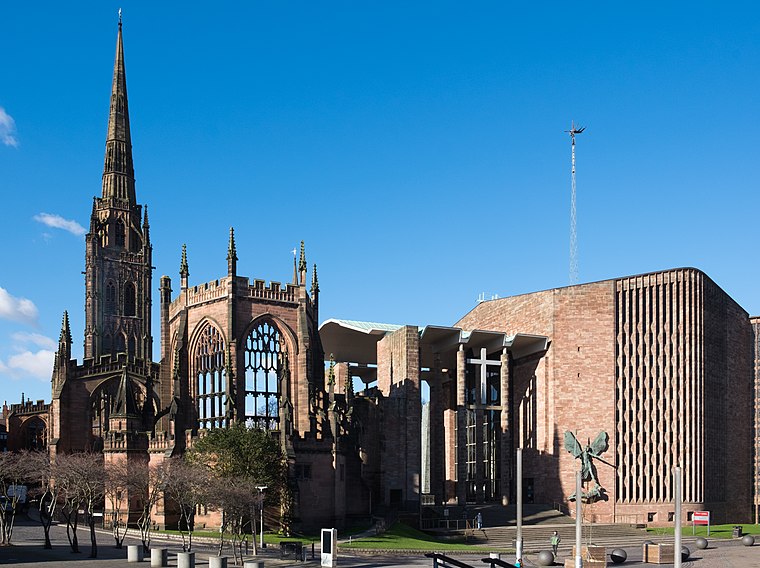
Photo: DeFacto, CC BY-SA 4.0.
The Cathedral Church of Saint Michael, commonly known as Coventry Cathedral, is the seat of the Bishop of Coventry and the Diocese of Coventry within the Church of England. Coventry Cathedral is situated 1 mile west of 2 Tone.
Stoke St Michael’s Church, Coventry
Church

Photo: Wikimedia, CC BY-SA 3.0.
Stoke St Michael's is the Church of England parish church of Stoke, Coventry which continues to serve as a place of worship in the community since its foundation in the 12th century by the Earl of Chester. Stoke St Michael’s Church, Coventry is situated 2,000 feet east of 2 Tone.
Places in the Area
Nearby places include Ball Hill and Stoke Heath.
Ball Hill
Suburb
Ball Hill is an area within the Stoke district of Coventry, West Midlands, England. It is to the east of Coventry city centre. Walsgrave Road is the main street that runs through Ball Hill, which is a name that primarily defines the shopping area extending from the brow of the hill down to the junction with Clay Lane and Brays Lane.
Stoke Heath
Suburb
Stoke Heath is a residential area of Coventry, in the county of the West Midlands, England. It is situated approximately 1 mile to the north east of the city centre.
Hillfields
Suburb
Hillfields is a suburb of Coventry in the West Midlands of England. It is situated north of Coventry city centre, and has undergone a series of name changes throughout its history originally called "Harnall" and has seen itself change from a village, to a remote suburb, to a large postwar redevelopment zone.
2 Tone
- Type: Café
- Address: 5, Walsgrave Road, CV2 4ED
- Location: Coventry, England, United Kingdom, Britain and Ireland, Europe
- View on OpenStreetMap
Latitude
52.41037° or 52° 24′ 37″ northLongitude
-1.48362° or 1° 29′ 1″ westOpen location code
9C4WCG68+4HOpenStreetMap ID
node 9737688505OpenStreetMap feature
amenity=cafe
This page is based on OpenStreetMap, Wikidata, and Wikimedia Commons.
We’d love your help improving our open data sources. Thank you for contributing.
Satellite Map
Discover 2 Tone from above in high-definition satellite imagery.
Notable Places Nearby
Highlights include 2 Tone Music Museum Village and Walsgrave Road Post Office.
Nearby Places
Explore places such as Cake Box and BRM Legal.
England: Must-Visit Destinations
Delve into London, Manchester, Sheffield, and Leeds.
Curious Cafés to Discover
Uncover intriguing cafés from every corner of the globe.
About Mapcarta. Data © OpenStreetMap contributors and available under the Open Database License". Text is available under the CC BY-SA 4.0 license, except for photos, directions, and the map. Photo: Mintchocicecream, CC0.