Stalybridge
Stalybridge is a railway stop in Tameside, England. Stalybridge is situated nearby to West Hill School, as well as near St George’s Church.| Tap on a place to explore it |
Places of Interest Nearby
Highlights include Stalybridge railway station and West Hill School.
Stalybridge railway station
Railway station

Photo: The Voice of Hassocks, Public domain.
Stalybridge railway station serves the town of Stalybridge, in Greater Manchester, England. It lies on the Huddersfield Line, 7+1⁄2 miles east of Manchester Piccadilly and 8+1⁄4 miles east of Manchester Victoria. The station is managed by TransPennine Express.
West Hill School
School
West Hill School is an 11–16 boys secondary academy, located in Stalybridge, Greater Manchester, England. The school was founded in 1927 as a school for only boys, the development in the Tameside borough has had multiple extensions and new buildings. included… West Hill School is situated 1,100 feet northwest of Stalybridge.
St George’s Church
Church

Photo: Bill Boaden, CC BY-SA 2.0.
St George's Church is in Church Walk, Stalybridge, Greater Manchester, England. It is an active Anglican parish church in the deanery of Ashton-under-Lyne, the archdeaconry of Rochdale and the diocese of Manchester. St George’s Church is situated 1,900 feet northeast of Stalybridge.
Places in the Area
Nearby places include Stalybridge and Heyrod.
Stalybridge
Town
Stalybridge is a town in Tameside, Greater Manchester, England. At the 2021 census, it had a population of 26,830. Historically divided between Cheshire and Lancashire, it is 8 miles east of Manchester and 6 miles north-west of Glossop.
Heyrod
Village

Photo: Wikimedia, CC BY-SA 2.0.
Heyrod is a village in Tameside, Greater Manchester, England, between Stalybridge and Mossley. Historically in Lancashire, Heyrod was subsumed into the Municipal Borough of Stalybridge in 1881, a local government district which became part of the administrative county of Cheshire in 1889.
Dukinfield
Town
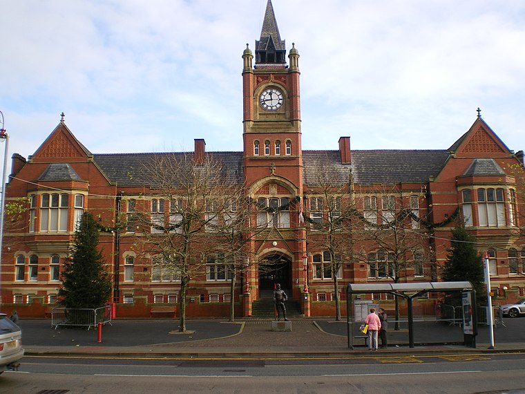
Photo: Wikimedia, CC BY-SA 2.0.
Dukinfield is a town in Tameside, Greater Manchester, England, on the south bank of the River Tame opposite Ashton-under-Lyne, 6.3 miles east of Manchester.
Stalybridge
- Type: Railway stop
- Categories: transport stop and transportation
- Location: Tameside, England, United Kingdom, Britain and Ireland, Europe
- View on OpenStreetMap
Latitude
53.48396° or 53° 29′ 2″ northLongitude
-2.06419° or 2° 3′ 51″ westOpen location code
9C5VFWMP+H8OpenStreetMap ID
node 9776991778OpenStreetMap feature
public_transport=stop_positionOpenStreetMap feature
railway=stop
This page is based on OpenStreetMap, Wikidata, and Wikimedia Commons.
We’d love your help improving our open data sources. Thank you for contributing.
Satellite Map
Discover Stalybridge from above in high-definition satellite imagery.
Places with the Same Name
Discover other places named “Stalybridge”.
Notable Places Nearby
Highlights include Stalybridge Train Station and Stalybridge Firestation.
Nearby Places
Explore places such as Stalybridge and Stalybridge Buffet Bar.
England: Must-Visit Destinations
Delve into London, Manchester, Sheffield, and Leeds.
Curious Railway Stops to Discover
Uncover intriguing railway stops from every corner of the globe.
About Mapcarta. Data © OpenStreetMap contributors and available under the Open Database License". Text is available under the CC BY-SA 4.0 license, except for photos, directions, and the map. Photo: Zboralski, CC0.