Maer Isidore Wartski Mayor
Maer Isidore Wartski Mayor is in Bangor, Gwynedd, Wales. Maer Isidore Wartski Mayor is situated nearby to the building The Boatyard, as well as near the sports venue Bangor Swimming Pool.| Tap on a place to explore it |
Places of Interest Nearby
Highlights include Tap & Spile, Garth and Port Penrhyn.
Tap & Spile, Garth
Hotel

Photo: Jaggery, CC BY-SA 2.0.
Tap & Spile, Garth is a hotel, which is situated 1,000 feet northwest of Maer Isidore Wartski Mayor.
Port Penrhyn
Dock

Photo: Linus Wolf, CC BY-SA 3.0.
Port Penrhyn is a harbour located just east of Bangor in north Wales at the confluence of the River Cegin with the Menai Strait. It was formerly of great importance as the main port for the export of slate from the Penrhyn Quarry, the largest slate quarry in the world at the end of the nineteenth century. Port Penrhyn is situated 1,700 feet east of Maer Isidore Wartski Mayor.
The Boatyard
Building

Photo: Jaggery, CC BY-SA 2.0.
The Boatyard is a building, which is situated 720 feet northwest of Maer Isidore Wartski Mayor.
Places in the Area
Nearby places include Llandygai and Hen Bentref Llandegfan.
Llandygai
Village

Photo: Llywelyn2000, CC BY-SA 4.0.
Llandygai is a small village and community on the A5 road between Bangor and Talybont in Gwynedd, Wales. It affords a view of the nearby Carneddau mountain range.
Hen Bentref Llandegfan
Village
Hen Bentref Llandegfan is a village in the community of Cwm Cadnant, Anglesey, Wales, which is 128.9 miles from Cardiff and 207.8 miles from London. It is near Llandegfan. "Hen Bentref" in Welsh means "the old village". Hen Bentref Llandegfan is situated 1½ miles northwest of Maer Isidore Wartski Mayor.
Llandegfan
Village
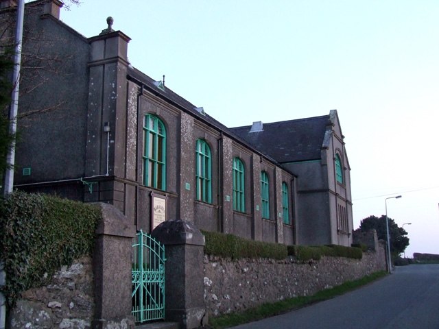
Photo: Nigel Williams, CC BY-SA 2.0.
Llandegfan is a village on the east of island of Anglesey in Wales. It is part of the community of Cwm Cadnant, and was its own community until 1984. Llandegfan's population is around 1,580. Llandegfan is situated 1½ miles northwest of Maer Isidore Wartski Mayor.
Maer Isidore Wartski Mayor
- Type: Sign
- Categories: information and tourism
- Location: Bangor, Gwynedd, North Wales, Wales, United Kingdom, Britain and Ireland, Europe
- View on OpenStreetMap
Latitude
53.23403° or 53° 14′ 3″ northLongitude
-4.11918° or 4° 7′ 9″ westOpen location code
9C5Q6VMJ+J8OpenStreetMap ID
node 9814781387OpenStreetMap feature
tourism=information
This page is based on OpenStreetMap, Wikidata, and Wikimedia Commons.
We’d love your help improving our open data sources. Thank you for contributing.
Satellite Map
Discover Maer Isidore Wartski Mayor from above in high-definition satellite imagery.
Notable Places Nearby
Highlights include Bangor Swimming Pool and Lord Nelson.
Nearby Places
Explore places such as Crosville Club and Crosville Social Club.
Gwynedd: Must-Visit Destinations
Delve into Tywyn, Caernarfon, Bardsey Island, and Porthmadog.
Curious Places to Discover
Uncover intriguing places from every corner of the globe.
About Mapcarta. Data © OpenStreetMap contributors and available under the Open Database License". Text is available under the CC BY-SA 4.0 license, except for photos, directions, and the map. Photo: Tanya Dedyukhina, CC BY 3.0.