Watkins Fish & Chips
Watkins Fish & Chips is a fast food restaurant in Allt-yr-Yn, Newport, Wales which is located on Bassaleg Road. Watkins Fish & Chips is situated nearby to Gaer Park Post Office, as well as near Liberty Church Newport.| Tap on a place to explore it |
- Opening hours:
Monday: closed
Tuesday: 4:30 PM—7:45 PM
Wednesday: noon—2:15 PM and 4:30 PM—7:45 PM
Thursday—Friday: noon—7:45 PM
Saturday: noon—7:15 PM
Sunday: closed - Type: Fast food restaurant
- Cuisine: fish and chips
- Also known as: “Watkins Fish and Chips”
- Address: 125 Bassaleg Road, Newport, NP20 3NA
Places of Interest Nearby
Highlights include St Woolos Cemetery and Newport Railway Station.
St Woolos Cemetery
Cemetery

Photo: Displaced1980, CC BY 3.0.
St Woolos Cemetery is the main cemetery in the city of Newport, Wales, situated one mile to the west of the Church in Wales cathedral known by the same name. St Woolos Cemetery is situated 780 feet north of Watkins Fish & Chips.
Newport Railway Station
Railway station
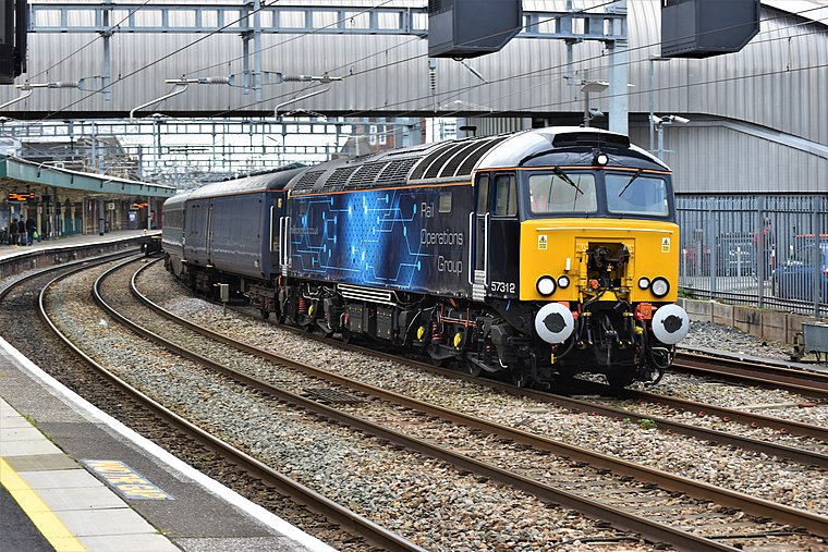
Photo: Wikimedia, CC BY-SA 2.0.
Newport is the second-busiest railway station in Wales. It is situated in Newport city centre and is 133 miles 13 chains from London Paddington measured via Bristol Parkway, and 158 miles 50 chains via Stroud. Newport Railway Station is situated 1 mile northeast of Watkins Fish & Chips.
St Woolos Hospital
Hospital

Photo: John Grayson, CC BY-SA 2.0.
Saint Woolos Hospital is located in the Stow Hill area of Newport, Wales. It is managed by the Aneurin Bevan University Health Board. St Woolos Hospital is situated 4,000 feet east of Watkins Fish & Chips.
Places in the Area
Nearby places include Ridgeway and High Cross.
Ridgeway
Suburb
Ridgeway is an area in Newport, Wales, in the electoral ward and community of Allt-yr-yn. It is well known for its ridge which overlooks Rogerstone and the nearby woodland areas.
High Cross
Suburb
High Cross is a suburb of the city of Newport, Wales, and forms part of the community of Rogerstone. The majority of the housing in the area was built in the 1930s on land formerly owned by the Tredegar Estate which at the time was outside the boundaries of the county borough of Newport.
Maesglas
Suburb
Maesglas or Maes-glas is a neighbourhood in the south west of the city of Newport, South Wales. In the 16th century it was recorded as Greenfield but the Welsh language name Maesglas has remained the more widely used, among English speakers.
Watkins Fish & Chips
- Categories: food and restaurant
- Location: Allt-yr-Yn, Newport, Wales, United Kingdom, Britain and Ireland, Europe
- View on OpenStreetMap
Latitude
51.58° or 51° 34′ 48″ northLongitude
-3.02055° or 3° 1′ 14″ westOpen location code
9C3RHXHH+XQOpenStreetMap ID
node 9863013664OpenStreetMap feature
amenity=fast_foodOpenStreetMap attribute
cuisine=fish_and_chips
This page is based on OpenStreetMap, Wikidata, and Wikimedia Commons.
We’d love your help improving our open data sources. Thank you for contributing.
Satellite Map
Discover Watkins Fish & Chips from above in high-definition satellite imagery.
Places with the Same Name
Discover other places named “Watkins Fish & Chips”.
Notable Places Nearby
Highlights include Gaer Park Post Office and Liberty Church Newport.
Nearby Places
Explore places such as Vibe Hair Studio and St David’s Hospice Care.
Wales: Must-Visit Destinations
Delve into Cardiff, Swansea, Llanfairpwllgwyngyll, and Bangor.
Curious Fast Food Restaurants to Discover
Uncover intriguing fast food restaurants from every corner of the globe.
About Mapcarta. Data © OpenStreetMap contributors and available under the Open Database License". Text is available under the CC BY-SA 4.0 license, except for photos, directions, and the map. Photo: WelshDave, CC BY-SA 4.0.