Free Time Grill
Free Time Grill is a fast food restaurant in Mönchengladbach, Düsseldorf, North Rhine-Westphalia. Free Time Grill is situated nearby to the marketplace Wochenmarkt, as well as near the church St. Michael.| Tap on a place to explore it |
Places of Interest Nearby
Highlights include St. Michael and Borussia-Park.

Borussia-Park
Stadium

Photo: Wikimedia, CC BY-SA 3.0 de.
Borussia-Park is a football stadium in Mönchengladbach, North Rhine-Westphalia, Germany which serves as the home stadium of Bundesliga club Borussia Mönchengladbach. Borussia-Park is situated 2 km southwest of Free Time Grill.
Abteiberg Museum
Museum
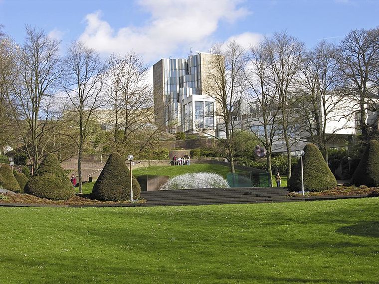
Photo: Hps-poll, CC BY-SA 3.0.
Museum Abteiberg is a municipal museum for contemporary art in the German city Mönchengladbach. Since the 1970s, the museum has been known for its experimental and avant-garde exhibitions, starting with director Johannes Cladders, and also its museum architecture, designed by Austrian architect Hans Hollein – a highpoint of postmodern design. Abteiberg Museum is situated 2 km northeast of Free Time Grill.
Places in the Area
Nearby places include Am Wasserturm and Hardter Wald.
Am Wasserturm
Neighborhood

Photo: Arcturus, CC BY-SA 3.0.
Am Wasserturm is a neighborhood, which is situated 2½ km northeast of Free Time Grill.
Hardter Wald
Hamlet

Photo: Huckety, CC BY-SA 3.0.
Hardter Wald is a hamlet, which is situated 5 km west of Free Time Grill.
Lürrip
Neighborhood

Photo: Chris06, CC BY-SA 4.0.
Lürrip is a neighborhood, which is situated 5 km northeast of Free Time Grill.
Free Time Grill
- Type: Fast food restaurant
- Cuisine: Greek
- Categories: food and restaurant
- Location: Mönchengladbach, Düsseldorf, Lower Rhine, North Rhine-Westphalia, Germany, Central Europe, Europe
- View on OpenStreetMap
Latitude
51.18254° or 51° 10′ 57″ northLongitude
6.40997° or 6° 24′ 36″ eastOpen location code
9F385CM5+2XOpenStreetMap ID
node 9866497615OpenStreetMap feature
amenity=fast_foodOpenStreetMap attribute
cuisine=greek
This page is based on OpenStreetMap, Wikidata, and Wikimedia Commons.
We’d love your help improving our open data sources. Thank you for contributing.
Satellite Map
Discover Free Time Grill from above in high-definition satellite imagery.
Notable Places Nearby
Highlights include Wochenmarkt and Haus des Sports.
Nearby Places
Explore places such as Schiffer and Dr. Vossieck Tinnitus und Hörsysteme.
Lower Rhine: Must-Visit Destinations
Delve into Düsseldorf, Krefeld, Neuss, and Kleve.
Curious Fast Food Restaurants to Discover
Uncover intriguing fast food restaurants from every corner of the globe.
About Mapcarta. Data © OpenStreetMap contributors and available under the Open Database License". Text is available under the CC BY-SA 4.0 license, except for photos, directions, and the map. Photo: CaS2000, CC BY-SA 3.0 de.