Brunnenhöhle
Brunnenhöhle is a cave in Bad Vöslau, Politischer Bezirk Baden, Lower Austria. Access is restricted and requires permission. Brunnenhöhle is situated nearby to the wayside shrine Pestsäule, as well as near the garden Capitulare Garten.| Tap on a place to explore it |
Places of Interest Nearby
Highlights include Schloss Gainfarn and Thermalbad, Bad Vöslau.
Schloss Gainfarn
Castle

Photo: Bwag, CC BY-SA 4.0.
Schloss Gainfarn is a castle, which is situated 320 metres southwest of Brunnenhöhle.
Thermalbad, Bad Vöslau
Park

Photo: Bwag, CC BY-SA 4.0.
Thermalbad, Bad Vöslau is a park, which is situated 370 metres northeast of Brunnenhöhle.
Pestsäule
Wayside shrine

Photo: Roberto Verzo, CC BY 2.0.
Pestsäule is a wayside shrine, which is situated 110 metres southwest of Brunnenhöhle.
Places in the Area
Nearby places include Bad Vöslau and Kottingbrunn.
Bad Vöslau
Town

Photo: Wolfgang glock, CC BY 3.0.
Bad Vöslau is a spa town and municipality in the state of Lower Austria. It is also known as the cradle of the Austrian red wine cultivation. The population, as of 2022, is 12,424.
Kottingbrunn
Village

Photo: Reinhold Stansich, CC BY-SA 3.0.
Kottingbrunn is a town in the district of Baden in Lower Austria in Austria.
Sooß
Village
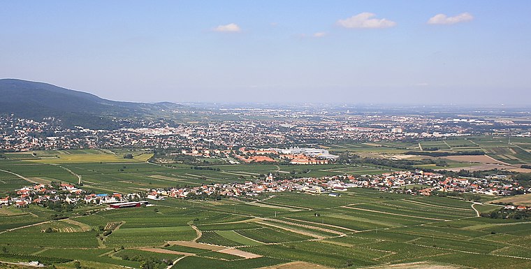
Photo: Bwag, CC BY-SA 3.0.
Sooß is a town in the district of Baden in Lower Austria, Austria.
Brunnenhöhle
- Access is restricted and requires permission.
- Type: Cave
- Category: landform
- Location: Bad Vöslau, Politischer Bezirk Baden, Lower Austria, Austria, Central Europe, Europe
- View on OpenStreetMap
Latitude
47.96476° or 47° 57′ 53″ northLongitude
16.20672° or 16° 12′ 24″ eastOpen location code
8FVRX674+WMOpenStreetMap ID
node 988144844OpenStreetMap feature
man_made=water_wellOpenStreetMap feature
natural=cave_entrance
This page is based on OpenStreetMap, Wikidata, and Wikimedia Commons.
We’d love your help improving our open data sources. Thank you for contributing.
Satellite Map
Discover Brunnenhöhle from above in high-definition satellite imagery.
Places with the Same Name
Discover other places named “Brunnenhöhle”.
Notable Places Nearby
Highlights include Capitulare Garten and Schloßpark Gainfarn.
Nearby Places
Explore places such as Dr. Ulrike Bayer and Wählamt Bad Vöslau.
Lower Austria: Must-Visit Destinations
Delve into St. Pölten, Wiener Neustadt, Amstetten, and Klosterneuburg.
Curious Caves to Discover
Uncover intriguing caves from every corner of the globe.
About Mapcarta. Data © OpenStreetMap contributors and available under the Open Database License". Text is available under the CC BY-SA 4.0 license, except for photos, directions, and the map. Photo: Lonezor, CC BY-SA 3.0.