Pont-Libert
Pont-Libert is a hamlet in La Riche, Arrondissement of Tours, Centre-Val de Loire. Pont-Libert is situated nearby to the hamlet Gare de Saint-Cosme, as well as near the locality Le Sauge.| Tap on a place to explore it |
Places of Interest
Highlights include Priory of St. Cosmas and Château de Plessis-lez-Tours.
Priory of St. Cosmas
Museum
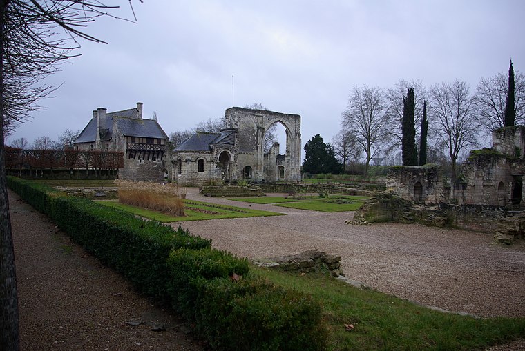
Photo: Duch.seb, CC BY-SA 3.0.
The Priory of St. Cosmas or the Priory of Ronsard is a former priory built upon an island in the river Loire at La Riche near Tours in Touraine, founded in the 11th century and dedicated to St.
Château de Plessis-lez-Tours
Castle

Photo: Wikimedia, CC BY-SA 2.5.
The royal Château de Plessis-lèz-Tours is the remains of a late Gothic château located in the town of La Riche in the Indre-et-Loire department, in the Loire Valley of France.

Places in the Area
Nearby places include Joué-lès-Tours and Tours.
Joué-lès-Tours
Town

Photo: Wikimedia, CC BY-SA 2.0 de.
Joué-lès-Tours is a commune in the department of Indre-et-Loire, Centre-Val de Loire, central France. It is the largest suburb of the city of Tours, and is adjacent to it on the southwest. Joué-lès-Tours is situated 4 km southeast of Pont-Libert.
Tours

Photo: Q3382841, Public domain.
Tours is the largest city in the region of Centre-Val de Loire, France. It is the prefecture of the department of Indre-et-Loire. The commune of Tours had 136,463 inhabitants as of 2018 while the population of the whole metropolitan area was 516,973.
Sanitas
Suburb

Photo: Reuillois, CC BY-SA 3.0.
Sanitas is a suburb, which is situated 5 km east of Pont-Libert.
Pont-Libert
- Type: Hamlet
- Category: locality
- Location: La Riche, Arrondissement of Tours, Indre-et-Loire, Centre-Val de Loire, France, Europe
- View on OpenStreetMap
Latitude
47.37922° or 47° 22′ 45″ northLongitude
0.63099° or 0° 37′ 52″ eastOpen location code
8FV29JHJ+M9OpenStreetMap ID
node 9895631714OpenStreetMap feature
place=hamlet
This page is based on OpenStreetMap, Wikidata, and Wikimedia Commons.
We’d love your help improving our open data sources. Thank you for contributing.
Satellite Map
Discover Pont-Libert from above in high-definition satellite imagery.
Localities in the Area
Explore places such as Gare de Saint-Cosme and Le Sauge.
Notable Places Nearby
Highlights include Centre de loisirs ‘Tot’aime’ and La Jocondie.
Centre-Val de Loire: Must-Visit Destinations
Delve into Orléans, Tours, Chartres, and Bourges.
Curious Hamlets to Discover
Uncover intriguing hamlets from every corner of the globe.
About Mapcarta. Data © OpenStreetMap contributors and available under the Open Database License". Text is available under the CC BY-SA 4.0 license, except for photos, directions, and the map. Photo: Popolon, CC BY-SA 3.0.