Colle Monforca
Colle Monforca is a peak in Asolo, Treviso, Veneto and has an elevation of 226 metres. Colle Monforca is situated nearby to the hamlet Barettina, as well as near Casonetto.| Tap on a place to explore it |
Places of Interest
Highlights include Castello di Asolo and Villa Scotti Pasini.

Villa Scotti Pasini
Manor estate
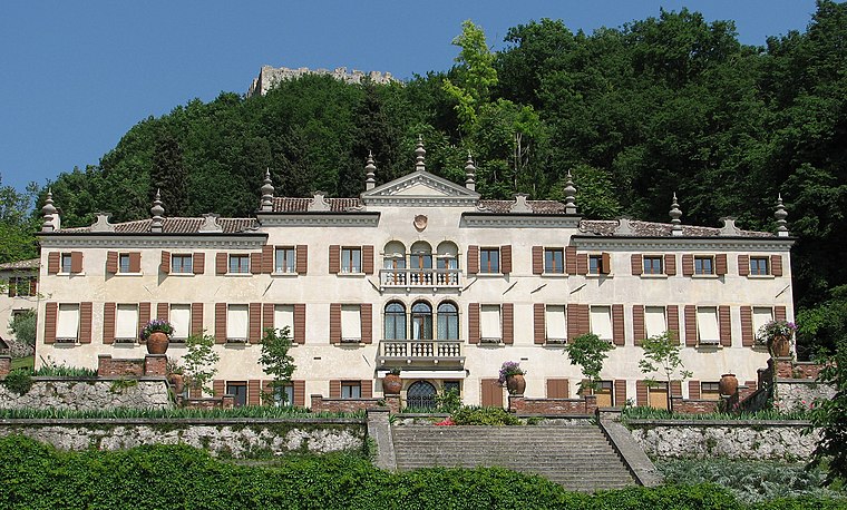
Photo: Patrick Denker, CC BY 2.0.
Villa Scotti Pasini is a manor estate.
Places in the Area
Nearby places include Fonte and Paderno del Grappa.
Fonte
Village

Photo: Marchetto da Trieste, CC BY-SA 4.0.
Fonte is a comune in the Province of Treviso in the Italian region Veneto, located about 50 kilometres northwest of Venice and about 35 kilometres northwest of Treviso.
Paderno del Grappa
Village

Photo: Syrio, CC BY-SA 4.0.
Paderno del Grappa is a small town and a frazione of Pieve del Grappa, a comune in the province of Treviso, in the Veneto region in Italy. Paderno del Grappa is located at the base of Mount Grappa, in the mountain range of the Venetian Prealps.

Colle Monforca
- Type: Peak with an elevation of 226 metres
- Category: landform
- Location: Asolo, Treviso, Veneto, Northeast Italy, Italy, Europe
- View on OpenStreetMap
Latitude
45.8124° or 45° 48′ 45″ northLongitude
11.9181° or 11° 55′ 5″ eastElevation
226 metres (741 feet)Open location code
8FQHRW69+X7OpenStreetMap ID
node 9927551176OpenStreetMap feature
natural=peak
This page is based on OpenStreetMap, Wikidata, and Wikimedia Commons.
We’d love your help improving our open data sources. Thank you for contributing.
Satellite Map
Discover Colle Monforca from above in high-definition satellite imagery.
Localities in the Area
Explore places such as Barettina and Casonetto.
Notable Places Nearby
Highlights include Monte di Santa Giustina and Forra cascata.
Treviso: Must-Visit Destinations
Delve into Treviso and Castelfranco Veneto.
Curious Peaks to Discover
Uncover intriguing peaks from every corner of the globe.
About Mapcarta. Data © OpenStreetMap contributors and available under the Open Database License". Text is available under the CC BY-SA 4.0 license, except for photos, directions, and the map. Photo: Villaararat, CC BY-SA 4.0.